- Remove Small landforms filter Small landforms
- Remove Faults filter Faults
- Remove Bømlo filter Bømlo
- Remove Maritime environments filter Maritime environments
- Remove Seabirds filter Seabirds
- Remove Monastery filter Monastery
- Remove Fitjar filter Fitjar
- Remove Avalanches and rock falls filter Avalanches and rock falls
- Remove Meland, frå 2020 del av nye Alver kommune. filter Meland, frå 2020 del av nye Alver kommune.
- Remove Mineral resources filter Mineral resources
- Remove Etne filter Etne
- Remove Thrust sheets filter Thrust sheets

Eldsfjellet
The eclogites in western Norway were formed when Precambrian basement rocks were squeezed and pressed down under great pressure deep under the Caledonian mountain chain. The process may well have triggered some of the deepest earthquakes the world has ever known. The clearest traces of this drama are found in and around Mt. Eldsfjellet, in peaceful Meland.

Holmeknappen
If you come by sea to Bergen and come up the Herdle Fjord, the yellow ochre marine shed at Holmeknappen is a well known landmark to starboard as you come close to the little shore settlement. In olden days Holmenknappen served important functions as a centre for a wide hinterland of the surrounding farms, warehouse, landing point, country store and later a steamer quay, a hotel (1896) and a dairy (1909). But today Holmeknappen is no longer a focal point. Transport and commercial routes have changed the old pattern


Lykling- gold
During the summer of 1979 a rock was found at Lykling in Bømlo that contained 450 grams of gold, and at the end of the 1980s a great many gold samples were laid out for sale. In the old mining area there are still gold miners hunting for the precious metal. But, the big adventure stories are a thing of the past.

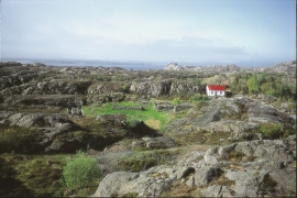
Siggjo
Siggjo is a cone-shaped, volcano-like mountaintop in the part of Hordaland where one finds the best preserved volcanic rocks. The rock types originate from one or several volcanoes that spewed out glowing lava and ash. But, the shape of the mountain, as it appears today, formed later and by completely different forces.


Urangsvågen-Rubbestadneset
In 1868 the first stone workers came to Rubbestadneset to take out the granite for the Skoltegrunns Pier, predecessor of the Skoltegrunns wharf in Bergen. Later granite was also taken out from the area, around Innværs Fjord and UransvågenN. The activity probably peaked around 1900, with over 40 men at work. 15 years later, it was finished.

Fitjarøyane
If we study the group of islands south of Selbjørns Fjord from the air or on a sea map, we will notice that many of the islands are elongated and lie systematically in rows. The islands are divided by long sounds, for example Trollosen, Nuleia and Hjelmosen, which are oriented in a south-southeast to north-northwesterly direction.

Grønafjellet
Mountain plants with their beautiful, colourful flowers are common in high altitude areas in Norway. On the coast there are not so many of them. But, here and there one nonetheless finds mountain plants, and this makes some coastal mountainsides a little bit different. Perhaps the growth on these mountainsides gives us a little glimpse of a distant past?

