- Remove Small landforms filter Small landforms
- Remove Trading posts and guesthouses filter Trading posts and guesthouses
- Remove Middle age filter Middle age
- Remove Civil servant dwellings and manors filter Civil servant dwellings and manors
- Remove Settlements, Villages, Towns filter Settlements, Villages, Towns
- Remove Maritime environments filter Maritime environments
- Remove Seabirds filter Seabirds
- Remove Monastery filter Monastery
- Remove Fitjar filter Fitjar
- Remove Ullensvang, frå 2020 del av nye Ullensvang kommune. filter Ullensvang, frå 2020 del av nye Ullensvang kommune.
- Remove Etne filter Etne
- Remove Rock carvings filter Rock carvings
- Remove Avalanches and rock falls filter Avalanches and rock falls
- Remove Bergen filter Bergen

Arnatveit
On the farm of Arnatveit, high up on the slope above the highway, an old smokehouse remains standing in the courtyard of the main farm property, in the place of the old common courtyard. Today this farm lies at the outskirts of a large housing estate. Most of the farmland of the other farm properties has been sold to benefit the city’s need of sites for the new community of Arna.

Bryggen
In the 1300s Bergen was a trading centre of European dimension. The town is thought to have had around 7000 inhabitants and was the largest and most important in the country. In a European context it was an average size town. At this time the most tightly built town area was still mostly east of Vågen from Holmen in the north to Vågsbotn in the south. Already in medieval times, latest in the 1340s, this area was called Bryggen.
Damsgård
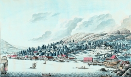
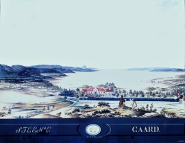
As a fairytale castle Damsgård Hovedgård lies on the slope rising up from the Puddefjord. The old connection between the farm and the sea, as we see it on Dreier’s prospectus from 1810, has been broken up by roads and encroachments in the building mass. But the main building itself is a central monument in Norwegian architecture from the 1700s – one of the finest representatives for the rococo period, with a magnificent and rich décor both in its interior and exterior.

Salhus
Salhus has been a connecting point for sea travellers far back in time. The name probably derives from the Old Norse word sáluhús, “house for travellers”. The name may indicate that this was a place for an inn even in the Middle Ages. The place is eminently situated in the route to and from Bergen. For travellers coming by boat from Sogn and Nordhordland, Salhus is the last stop before Bergen. Travellers from the communities in Voss also came this way earlier when they were going to Bergen
Stend
Garden Stend høyrde i mellomalderen til Nonneseter kloster. Etter reformasjonen var han i eiga til Vincents Lunge fram til 1680. Då overtok generaltollforvaltar Hans Christophersøn Hiorth eigedommen. Hiorth vart adla i 1682, og Stend fekk status som adeleg setegard. Truleg fekk den staselege hovudbygningen si form i Hiorths embetstid.

Vågsbunnen
Vågsbotn was the name of the innermost part of the eastern part of town from Auta-almenning (today’s Vetrlidsalmenning), skirting the bottom of Vågen to Allehelgenskirken (All Saints’ Church) (at the present Allehelgensgate). In early medieval times Vågen reached almost all the way to Olavskirken (the Cathedral). It was a relatively wide bay inside the premonitory where Korskirken was built. The area was therefore much shorter than what is known as Vågsbunnen today.
Kyrping
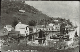
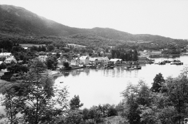
The trading post down by the fjord at Kyrping does not belong to the oldest group of trading posts from the 1600s and 1700s. It was only after the liberalisation of the trading legislation that trade was established here.
Skånevik- the trading post
There are only two buildings left of the old trading and guesthouse settlement in Skånevik. They are in the centre, close to the main road passing through the settlement. The other buildings that belonged to the place, the lodging house (“Holteriet”), the bakery, the courthouse, the boathouse and the sea house with the store, were pulled down in the last century.

Engesund
For more than 350 years Engesund has been a place for hostelries and trading in the Fitjar islands. The place is centrally placed in the shipping lane, with a sheltered harbour close to the exposed Selbjørnsfjorden. Engesund was once part of the great network of historical stopover places on the coast.

