- Remove Smallholdings filter Smallholdings
- Remove Thrust sheets filter Thrust sheets
- Remove Lakes, rivers and river networks filter Lakes, rivers and river networks
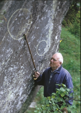
- Remove Rock carvings filter Rock carvings
- Remove Faults filter Faults
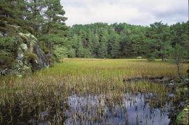
- Remove Wetland filter Wetland

Vernøya
If you smell a foul smell out in nature, you mustn't immediately think that the reason is cloaca from houses or cabins. The reason can be an entirely natural process that occurs when plants are broken down under special conditions. When there is little oxygen available, hydrogen sulphide can be produced. This is a gas that seeps up from the earth and smells like rotten eggs.

Hamlagrø
The type of underlying rock can be decisive for how many different types of plants are found in an area. In the area around Hamlagrø-lake the diversity is especially obvious. The geological conditions change much here within a short distance.

Lønaøyane
The Strandaelvi river is forever protected from the development of hydropower. The Lønaøyane islands – which comprise the delta furthest north in Lake Lønavatnet - are a part of this water system. In 1995 the level of protection for the Lønaøyne islands was strengthened to that of a nature preserve because of the rich birdlife in this wetland.


Myrkdalsdeltaet
Mykdal delta had an unusually diverse bird life, right up until 1987. The Myrkdal delta should have been protected, and the plans were prepared. Despite the area's high elevation at 227 m a.s.l., it had a wide variety of bird species compared with other fresh water wetlands in inner Hordaland. Several of the bird species were also unusual for the region. The delta had for example a permanent nesting colony of Eurasian Wigeon, believed to be the only one of its kind in the municipality.
Nordheim
"And here these endless kingdoms and these toils for a rich working life far and wide have lain and slept for a hundred thousand years! Right up until the Voss Railway came in 1883 and woke them, like the prince in the fairytale who awakened the Sleeping Beauty."

Rekvesøyane
The sediment that was deposited from the river Dyrvo has created the fan-shaped delta Rekvesøyane. The bit of land farthest out toward the water gets periodically flooded, especially during snow melt and after periods of much rain.