- Remove Smallholdings filter Smallholdings
- Remove Large landforms filter Large landforms
- Remove Chieftains and royal lines filter Chieftains and royal lines
- Remove Quarries filter Quarries
- Remove Maritime environments filter Maritime environments

Eksingedalen- landscape
Eksingedalen alternates between wide, flat flood plains with good farmland, and narrow passages with waterfalls where the roads cling to the mountainsides. The alternations in the landscape are a result of the sculpturing work by glaciers over several ice ages, and the deposition of the glacial river deposits when the last glacier finally melted back.

Dyrdal
If you journey along Austfjorden, you at the same time turn the pages of time back through Ice Age history. The landforms show how the landscape has developed gradually as the glaciers have grown - and melted again - in several episodes: from small cirques, we see innermost at Dyrdal, to larger fjords, like at Mas fjord further out.


Eldsfjellet
The eclogites in western Norway were formed when Precambrian basement rocks were squeezed and pressed down under great pressure deep under the Caledonian mountain chain. The process may well have triggered some of the deepest earthquakes the world has ever known. The clearest traces of this drama are found in and around Mt. Eldsfjellet, in peaceful Meland.


Goltasundet
For generations the land-seine was the most important tool for catching herring and mackerel, and therefore a suitable casting bay was worth its weight in gold. Goltasundet (the Golta sound) on Golta was such a place. Here the herring often drifted in and fantastic casts might be made here.


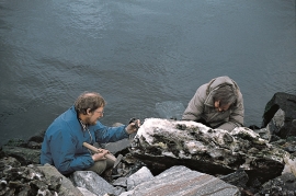
Ågotnes- crystals
Road cuts and blast areas are a joy to rock collectors, even if the disturbance to nature is ever so disfiguring. These are the best kinds of places to hunt for crystals, which otherwise are removed by weather and wind. In the Ågotnes area there are especially many beautiful crystals to be found.

