- Remove Cultural landscapes filter Cultural landscapes
- Remove Samnanger filter Samnanger
- Remove Voss, frå 2020 del av nye Voss herad. filter Voss, frå 2020 del av nye Voss herad.
- Remove Coniferous forests filter Coniferous forests
- Remove Ulvik filter Ulvik
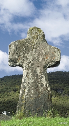
- Remove Stone crosses filter Stone crosses
- Remove Sediments filter Sediments


Holo
I Kvassdalen var det aktiv stølsdrift med mjølking av kyr og geitehald nokre år inn i vårt tusenår, og slik hadde det vore i meir enn to hundre år. Såleis har dalen ikkje fått gro til med kratt og skog, men er open og lys. Fortsett er det beiting av kyr og sauer.

Lona
One does not need much imaginationto see that where the river bends down in Røssebotnen, there has once been a lake. The landscape tells this - more clearly than any book.


Osa
At the bottom of the Osa fjord there is a cultural landscape marked by great contrasts; the wide terraces and the river delta at the fjord contrast with the steep hillsides in the background, where Norddalen leads up to the mountain. There are two farms here. Osa and Sævartveit – the farm at the river mouth and the hollow by the sea.

Rallarvegen
They rest there, all as one, the silent witnesses of Western Norway's saga of creation: Precambrian basement, phyllite and thrust sheet. In the end came the glaciers and sculptured the vast landscape. Along the ground or on the horizon, from bicycle or on foot - the landscape tells its story - and it tells it clearer on Rallarvegen than many other places.


Ulvik-village
The ice cap that covered the land during each of the 40 past ice ages over the past 2 million years of Earth's history pressed down the crust of the earth - like a finger on a rubber ball. And when the ice finally loosened its grip 11,000 years ago, the earth's crust rose again, most where the ice was thickest, least where it was thin, quickly in the beginning, and later more slowly. To this day, the land in the inner part of Norway continues to rise by perhaps one millimetre per year. By and large, however, the crust in Hordaland has again reached equilibrium after the weight of the ice was removed.

Ulvund
One of the oldest farms in Myrkdalen, Ulvund, is recognized as one of 14 areas in Hordaland having an especially valuable cultural landscape. The dirt road runs along a steep slope down toward Lake Myrkdalsvatnet. The flattest field, which today is harvested for silage, used to be an old grain field, while the slopes were old hayfields.

