- Remove Cultural landscapes filter Cultural landscapes
- Remove Midthordland filter Midthordland
- Remove Deciduous forests filter Deciduous forests
- Remove Basement rocks filter Basement rocks
- Remove Iron age filter Iron age
- Remove Coniferous forests filter Coniferous forests
![The Boat Hall at the Horda Museum houses 26 clinker-built, open wooden boats](https://www.grind.no/sites/default/files/styles/medium/public/bilder/sted/190/kvh_266_hordamuseet_2_150_0.jpg?itok=hUA-sFmd)
![This is what the northernmost part of the fishing village might have looked like in Viking times](https://www.grind.no/sites/default/files/styles/medium/public/bilder/sted/232/kvh_288-4.jpg?itok=mGnXIxYE)
![Archaeological fins from the sites at Risøya.](https://www.grind.no/sites/default/files/styles/medium/public/bilder/sted/232/kvh_276-2.jpg?itok=hxoLOQ5s)
![The royal mound at Hop, Askøy](https://www.grind.no/sites/default/files/styles/medium/public/bilder/sted/232/kvh_270-2.jpg?itok=09oK1K5S)
![The combination building at Nordvik.](https://www.grind.no/sites/default/files/styles/medium/public/bilder/sted/232/kvh_250-2.jpg?itok=CxcVlWaV)
![This little mountain in the picture sticks up because the layers are tilted on their sides.](https://www.grind.no/sites/default/files/styles/medium/public/bilder/sted/232/oygard_21.jpg?itok=ugcTumKb)
![The saw tooth pattern is clearly visible from Skora Mountain southwards toward Tellnes and Skogsvågen.](https://www.grind.no/sites/default/files/styles/medium/public/bilder/sted/232/fjell_26.jpg?itok=JF-ZMEUU)
Haganes
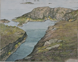
The gneiss landscape west and north of Bergen viewed in profile can remind us of a saw blade of the kind that has long, slanted sides that get broken off shorter transverse sides. It has taken several hundred million years to file this saw blade, an enduring interplay between various geological processes.
![Curvy scours in the bedrock (](https://www.grind.no/sites/default/files/styles/medium/public/bilder/sted/232/sund_23.jpg?itok=fisI_JUk)
Golta- Gneiss
Over thousands of years, autumn storms and strong land-driving winds have cleaned the bare rocks of Golta. The waves can beat far in over land and make it dangerous to walk along the shoreline. When the storms have calmed, the results of their work comes into view.
![Stone quarry in Kollevågen, 1922](https://www.grind.no/sites/default/files/styles/medium/public/bilder/sted/232/askoy_21.jpg?itok=Xnws-T7D)
![Slåttene](https://www.grind.no/sites/default/files/styles/medium/public/bilder/sted/232/sam_14.jpg?itok=TPx2vADn)