- Remove Bronze age filter Bronze age
- Remove Igneous rocks filter Igneous rocks
- Remove Sunnhordland filter Sunnhordland
- Remove Coniferous forests filter Coniferous forests


Ånuglo
Take a tour to Ånuglo on a warm summer's day. You can anchor up in Skipavågen and go exploring along the beach. Or, you can find giant holly trees and ivy inland on the island. If you take a trip to the small farms on the west side - one of which is still in operation - you can experience colourful flower meadows from a time most dream of, but few can still remember.

Espevik
220 million years ago, glowing hot molten rock masses intruded into fractures in the earth's crust in the outer parts of Hordaland. Some of these are believed to have reached the surface and formed lava flows, which since have been eroded away by wind and weather. But, most of these flows solidified into diabase sills before they got to the surface.

Fitjarøyane
If we study the group of islands south of Selbjørns Fjord from the air or on a sea map, we will notice that many of the islands are elongated and lie systematically in rows. The islands are divided by long sounds, for example Trollosen, Nuleia and Hjelmosen, which are oriented in a south-southeast to north-northwesterly direction.

Storsøya Island
On Storsøya Island, English ivy grows nearly everywhere. It creeps along the ground and climbs all the way to the top of the tree trunks. Together with holly, the trees of juniper, yew and an unusual pine forest keep the island green the whole year 'round.

Kattnakken–Stovegolvet
The highest mountainous area on Stord, including Kattnakken, Midtfjellet and Stovegolvet, has more in common with the mountainous terrain on the mainland than in the low coastal landscape of Sunnhordland. The volcanic bedrock together with the erosive powers of nature has resulted in a unique plateau landscape.

Hisøya
"I am going to prove to you that I am right". That is what the idealist and county doctor Christian Heitmann is supposed to have said in the early 1890s. He sat together with the parish priest, Kullmann, at Heitmann's home in Stord and discussed whether the islands in western Norway could have been forested or not. The priest thought that the area was too barren and weather-beaten for forest to have been able to grow so far out in the sea. But, Heitmann was sure he was right. He challenged the scepticism and set off to work.

Urangsvågen-Rubbestadneset
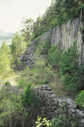
In 1868 the first stone workers came to Rubbestadneset to take out the granite for the Skoltegrunns Pier, predecessor of the Skoltegrunns wharf in Bergen. Later granite was also taken out from the area, around Innværs Fjord and UransvågenN. The activity probably peaked around 1900, with over 40 men at work. 15 years later, it was finished.

Siggjo
Siggjo is a cone-shaped, volcano-like mountaintop in the part of Hordaland where one finds the best preserved volcanic rocks. The rock types originate from one or several volcanoes that spewed out glowing lava and ash. But, the shape of the mountain, as it appears today, formed later and by completely different forces.

