- Remove Quarns and mills filter Quarns and mills
- Remove Tourism filter Tourism
- Remove Farm sites filter Farm sites
- Remove Lakes, rivers and river networks filter Lakes, rivers and river networks
- Remove Bømlo filter Bømlo
- Remove Kvam filter Kvam
- Remove Sund, frå 2020 del av nye Øygarden kommune filter Sund, frå 2020 del av nye Øygarden kommune
- Remove Quarries filter Quarries

Golta- Long house
In the years between the wars a major registration of houses and house costumes, house construction methods, fireplaces and forms of housing clusters was started in West Norway – an ambitious mapping of everything that came under the name “Registration of Culture and Geography in West Norway”. One of the places of which material was gathered in 1938 was an old multi-room house at Golta; new and interesting material for the researchers from the Historical Museum, but well known within the local building tradition through several generations.

Siggjo
Siggjo is a cone-shaped, volcano-like mountaintop in the part of Hordaland where one finds the best preserved volcanic rocks. The rock types originate from one or several volcanoes that spewed out glowing lava and ash. But, the shape of the mountain, as it appears today, formed later and by completely different forces.

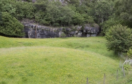
Urangsvågen-Rubbestadneset
In 1868 the first stone workers came to Rubbestadneset to take out the granite for the Skoltegrunns Pier, predecessor of the Skoltegrunns wharf in Bergen. Later granite was also taken out from the area, around Innværs Fjord and UransvågenN. The activity probably peaked around 1900, with over 40 men at work. 15 years later, it was finished.

Nes
The farm Nes lies directly inside Mundheim on a forested headland in the fjord between Mundheimsvika and Bondesundet, a farm with an attractive and well-kept cultural landscape.

Norheim
Norheim, “the farm by the narrow sound” is mentioned in a diploma from the Middle Ages and in an inheritance document. This is one of the large farms in Hardanger, of those that belonged to the powerful families; Sandven in Kvam, Torsnes in Jondal, Aga in Ullensvang and Spånheim in Ulvik.


