- Remove Quarns and mills filter Quarns and mills
- Remove Wetland filter Wetland
- Remove Fitjar filter Fitjar
- Remove Bronze age filter Bronze age
- Remove Os, frå 2020 del av nye Bjørnafjorden kommune filter Os, frå 2020 del av nye Bjørnafjorden kommune
- Remove Farm sites filter Farm sites
- Remove Road constructions filter Road constructions
- Remove Large landforms filter Large landforms

Ferstad
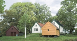
Ferstad is well worth a visit. The farm lies on a little hillock south of Lekven: a beautiful official residence from the 1700s.

Fitjarøyane
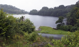
If we study the group of islands south of Selbjørns Fjord from the air or on a sea map, we will notice that many of the islands are elongated and lie systematically in rows. The islands are divided by long sounds, for example Trollosen, Nuleia and Hjelmosen, which are oriented in a south-southeast to north-northwesterly direction.

Grødalshaug
At the bottom of Vargavågen on Halhjem lies Grødalshaug, a 30 metres high rocky outcrop between the bay and a moist valley cleft. On the south side of the rock is a steep rock cliff facing the valley, the bog and the stream. On this rock face we find rock carvings from the Bronze Age.


Rimbareid- Vestbøstad
At nesting time you cannot avoid hearing the calls of the curlew or the snipe along the narrow road through the cultural landscape from Rimbareid to Vestbøstad. And on late summer evenings, the intense song of the sedge warbler rings out over the two characteristic tarns in the area.

Rimsvarden
Rimsvarden lies high and unencumbered, an enormous stone mound on the highest top with a wide view of the Fitjar rural community. With its 30 meters across and almost 4 meters high, this is one of the largest prehistoric burial relics existing in Hordaland.