- Remove Smallholdings filter Smallholdings
- Remove Basement rocks filter Basement rocks
- Remove Hardanger og Voss filter Hardanger og Voss
- Remove Mountain farms filter Mountain farms
- Remove Waterfalls filter Waterfalls
- Remove Mineral resources filter Mineral resources
- Remove Deciduous forests filter Deciduous forests
- Remove Railroad filter Railroad

Agastølen
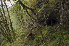
Whoever wanders the mountain plateau will form time to time hit upon old mountain summer farms, with solid old stone sheds, half sunk into the ground; a building tradition that has roots into prehistoric times. When we have been satiated with untouched Nature, it is somewhat comforting to come upon the old mountain chalets - they represent a type of human encroachment that we not only accept, but appreciate. They arouse a feeling of recognition and are a distinct witness to how people in the rural communities have made use of even the most remote resources.

Måbødalen- geology
The old pack road had 1500 steps, where cars today gas through the mountain. The time of this hard work is over, and of getting used to the steep terrain, as well; only the view from the top is much the same as before. Vøringsfossen in summer is one of Western Norway’s biggest natural wonders. It marks the transition between the older, open part of the Sysendalen valley and the younger, narrow and winding valley of Måbødalen.


Joberget
Flowering lime is one of nature's blessings: The nectar gives clear honey. The flower is used as folk medicine. From the inner bark of the lime tree one can make strong rope. Elderly folk can still tell how they got a weather report from the lime tree. If it smelled strong, it was probably going to rain. Lime often grows together with elm, ash and other tree species of the deciduous forest. Pure lime forests are rarer. Granvin has Hordaland's biggest lime forests.

Lussand- geology
Hardangerfjorden kløyver Hordaland i to. Den etter måten rettlinja fjorden skjer seg liksom på skeive inn i landet. Ikkje som Sognefjorden og Nordfjord – dei krokar og buktar seg innover meir eller mindre vinkelrett på kysten. Hardangerfjordens utforming har røter 400 millionar år tilbake i tida, då den veike sona i fjellet, der isen seinare tok grådig for seg, vart danna. Denne sona stig på land ved Lussand.

Uranes
One of the most magnificent deciduous forests in Hordaland grows along the border with Kvam. The rich growth comes from the phyllite and mica schist bedrock, together with a good climate. Along the fjord the summer is warm but not too dry, and in winter it is not too cold for plants that do not tolerate the frost.

Bergensbanen
Already at the beginning of the 1870s demands were made that there had to be a railway connection between Bergen and East Norway. The first section between Bergen and Voss was finished in 1883. The route alternatives further on were many: Lærdal-Valdres, Aurland-Geiteryggen, Raundalen-Finse and Ulvik-Finse. Following a long dispute, an agreement was finally reached that the middle route alternative, Raundalen- Myrdal- Finse, was the best alternative. In 1894 the government passed a resolution that the Bergen railway should be built, but only the section Voss-Taugevatn. This was a political gamble in order to make the rest of the country participate in the plans. In 1898 it was approved that the railway be continued eastwards from Taugevatn to Oslo. This high mountain project was one of the most challenging railway projects in Europe. The Bergen railway was to be built across a mountain plateau without roads.

Bergensbanen- snow measurements
Opponents of the Bergen Railway used the snow argument for all it was worth. During the debate in Parliament before the decision about the route was reached in 1894, fears of snowfalls of over 20 metres were presented.

Rallarvegen
They rest there, all as one, the silent witnesses of Western Norway's saga of creation: Precambrian basement, phyllite and thrust sheet. In the end came the glaciers and sculptured the vast landscape. Along the ground or on the horizon, from bicycle or on foot - the landscape tells its story - and it tells it clearer on Rallarvegen than many other places.