- Remove Museum filter Museum
- Remove Archaeological findings filter Archaeological findings
- Remove Boat- and shipyards filter Boat- and shipyards
- Remove Defense filter Defense
- Remove Etne filter Etne
- Remove Kvam filter Kvam
- Remove Conservation area filter Conservation area
- Remove Masfjorden filter Masfjorden
- Remove Trading posts and guesthouses filter Trading posts and guesthouses
- Remove Meland, frå 2020 del av nye Alver kommune. filter Meland, frå 2020 del av nye Alver kommune.
- Remove Hydro power filter Hydro power

Hummelfossen
As early as 1906 the Matre and Haugsdal waterway was bought up by the businessman Blauuw from Bergen; the first “waterfall speculator” in the Matre area. He immediately resold it to Fr. Hiorth, who transferred all the rights to the company Matrefaldene in 1908. Behind A/S Matrefaldene were German interests, Badische Anilin und Sodafabrik, which wanted to start production of saltpetre fertilizer with nitrogen and electricity.


Matrehola
On a large gravel terrace in Matredalen (the Matre valley), a couple of kilometres from the coastal settlement Matre, lies Storseterhilleren, at the end of a large stone block that came rushing down from the mountain. The Matre river runs just over 100 metres to the east of the cave.


Raunøya
The sea birds discovered it long ago. Raunøya and the surrounding islands are the most beautiful places in Masfjorden.


Håøy
Håøy lies centrally in one of the main shipping lanes going into Bergen --- with Håyøsund on the south side facing Meland, and Hagelsundet facing Lindåslandet. Names like Nordfarskista and Nordfarsskorane explain things. The strategic position was important in Viking times and it has been important in our days too. The beacon on Håøy can have been built in the establishment of the coastal administration in Håkon the Good’s time, about 950 AD. The defence structure of which we say remains on Håøy Summit held a critical position during Norwegian neutrality during the First World War. The defence structure was taken down in 1957.
Kyrping
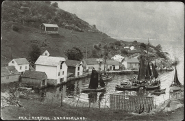
The trading post down by the fjord at Kyrping does not belong to the oldest group of trading posts from the 1600s and 1700s. It was only after the liberalisation of the trading legislation that trade was established here.


