- Remove Small landforms filter Small landforms
- Remove Farm sites filter Farm sites
- Remove Fish filter Fish
- Remove Eidfjord filter Eidfjord
- Remove Modalen filter Modalen
- Remove Radøy, frå 2020 del av nye Alver kommune. filter Radøy, frå 2020 del av nye Alver kommune.

Hjølmo
In the steep hillside in Hjølmodalen, a small side valley from Øvre Eidfjord (Upper Eidfjord), which has been a key entrance to the Hardanger Plateau, the hamlet of old farmhouses still lie clustered together. The yard is empty today, some of the houses are used in the summer, but the grass grows round all the corners.

Kjeåsen
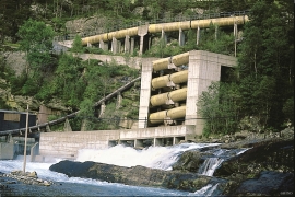
High up above the fjord, at a height of 600m lie the two holdings at Kjeåsen. Today you can drive there by car, through a new tunnel that the power engineers in Sima have drilled. Until 1974 the only road went up the steep hillside, along iron bolted ladders across dizzying rocks – a road for the strong at heart.

Måbø
Måbø is the uppermost farm in Måbødalen. This narrow and steep mountain valley has been one of the routes from the fjord communities up to the mountain plateau from times immemorial. We are not certain of the meaning of the name Måbø. Perhaps it has its origin in an Old Norse male name Mávi, from the name for seagull, már. The last syllable “bø” means farm. Today Måbø gives us a compact close-up of the subsistence economy: the small farm with the clearance piles, stone walls and a lane that guided the animals into the yard, at the foot of the great mountain expanse.

Nottveit
In one of the frame-built haysheds at Nottveit, at holding No. 3, we discover that several of the staves have a medieval look, with large dimensions and carefully rounded edges. According to tradition, it was the farms Nottveit and Mostraumen that supplied the timber for the stave church at Mo, and it is not unlikely that these farms received the old timber in return when the new church was erected there in 1593.

Otterstad
Tthe Otterstad farms lie in the innermost part of Mofjorden, on the northwest side of the river. The row of stave-built boatsheds that belong to the farm were probably constructed a little after the middle of the 1800s. Both here and on the Mo side, the boatsheds were important storage places at the seashore; wood and other farm products intended for the town; corn and merchandise in return.

Boga
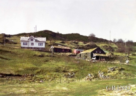
In the lightly undulating landscape at Boga there lies an old house with several rooms on a small rise. In fact it looks like three houses built into one another; a scullery, a living room and a store with a loft. From other sources we know that this house had covered passageways and sheds round all the walls in the 19th century; a compressed “long house” with inter-connections between all the rooms. This is a building style from the Middle Ages that we see traces of; a building corresponding to those we have seen remains of at Høybøen in Fjell and Lurekalven in Lindås. Bogatunet was restored in 2006.
Øvre Tveiten
On an east-facing slope above Halllandsvatnet lies the farm hamlet of Øvre Tveiten, two kilometres north of Manger. The stone hayshed lies with its gable out into the sloping terrain, and the old dwelling house, a little long house, has solid stone walls on three sides. But inside the walls the hayshed and the living rooms are wooden buildings.

Krækkjavassdraget
Few other animal species on Hardangervidda have been as much the focus of scientific research as the spotted trout. The spotted trout is considered to be a genetic variant of brown trout. It lives in parts of the Krækkjav water system. Otherwise, on a world scale, this species is only found in a small area in Kaukasus, and possibly also in a lake in Rondane.