- Remove Small landforms filter Small landforms
- Remove Maritime environments filter Maritime environments
- Remove Seabirds filter Seabirds
- Remove Monastery filter Monastery
- Remove Sund, frå 2020 del av nye Øygarden kommune filter Sund, frå 2020 del av nye Øygarden kommune
- Remove Fitjar filter Fitjar
- Remove Osterøy filter Osterøy
- Remove Chieftains and royal lines filter Chieftains and royal lines
- Remove Fisheries filter Fisheries
- Remove Mineral resources filter Mineral resources
- Remove Granvin, frå 2020 del av nye Voss herad filter Granvin, frå 2020 del av nye Voss herad
- Remove Lakes, rivers and river networks filter Lakes, rivers and river networks
- Remove Vaksdal filter Vaksdal

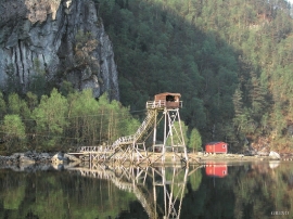
Granvinsvassdraget
After the ice age, Granvin Fjord reached all the way up under Skjervsfjossen waterfall. Just a thousand years later, as a result of the rising of the land after the ice melted, this whole inner part of the fjord freed itself of the sea and became Granvinsvatnet lake. In spite of this rise in elevation, this waterway is still navigable for fish: Sea trout have wandered into Granvinsvatnet in more recent times and evolved to become freshwater trout. And salmon and sea trout made the journey 13 kilometres up the Storelvi river.


Golta- Long house
In the years between the wars a major registration of houses and house costumes, house construction methods, fireplaces and forms of housing clusters was started in West Norway – an ambitious mapping of everything that came under the name “Registration of Culture and Geography in West Norway”. One of the places of which material was gathered in 1938 was an old multi-room house at Golta; new and interesting material for the researchers from the Historical Museum, but well known within the local building tradition through several generations.

Goltasundet
For generations the land-seine was the most important tool for catching herring and mackerel, and therefore a suitable casting bay was worth its weight in gold. Goltasundet (the Golta sound) on Golta was such a place. Here the herring often drifted in and fantastic casts might be made here.

Skogsvåg
Kval i våg! Når det ropet gjekk, var det berre å få ut den kraftige kvalnota til å stengja vågen med, og så kunne veidinga ta til. I uminnelege tider har det vore drive kvalveiding i Skogsvågen.


Mjøsvågen
Around Mjøsvågen here is still a compact marine use area. Some of the buildings are common boathouses, but most of them also house small enterprises and workshops. This is where the farmers from Øvsthus, Mjøs, Hole and other farms have supplemented their meagre incomes as smiths, brass moulders, clog makers, chest builders and decorative painters.

Storavatnet- Red-throated diver
The troll-like sounds from the Red-throated diver carry long distances between the mountains around Storavatnet. The high-pitched, haunting screeches on quiet evenings in May are a sign that the mating season has begun.

Eksingedalen- hydropower development
Water discharge at the outlet of the Ekso into Eidsfjord was halved after the big hydropower development in the mountainous area between Modalen and Eksingedalen and further southward toward Evanger in the 1960s, 70s and 80s. In an attempt to amend the changed environmental conditions in the waterway the developer built 35 small dams in the river.
Straume- Salmon
From times immemorial salmon and trout have been caught with various tools in the fjord and the streams here. Finds in the Stone Age settlements at Skipshelleren indicate that salmon was probably caught by angling. Nets, fish pots and traps have been used in the rivers right up to our times. In the fjords the use of nets was developed into a salmon seine around 1500, and later into what today is known as fixed seine.

