- Remove Small landforms filter Small landforms
- Remove Wetland filter Wetland
- Remove Farming and forestry filter Farming and forestry
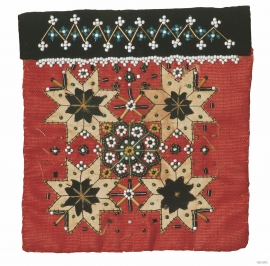
- Remove Vernacular arts filter Vernacular arts
- Remove Maritime environments filter Maritime environments
- Remove Seabirds filter Seabirds
- Remove Monastery filter Monastery
- Remove Fitjar filter Fitjar
- Remove Ullensvang, frå 2020 del av nye Ullensvang kommune. filter Ullensvang, frå 2020 del av nye Ullensvang kommune.
- Remove Etne filter Etne
- Remove Rock carvings filter Rock carvings
- Remove Middle age filter Middle age
- Remove Vernacular crafts filter Vernacular crafts

Etnedeltaet
During the latter half of the 1900s the big natural river deltas on Westland disappeared. Until the 1980s there was still a small, but significant remnant of the original river delta from the Etneelva river, but today most of this, too, is industrial land.

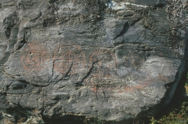
Helgaberget
Helgaberget – the holy hill – is a little rocky crag which thrusts itself a few metres above the terraced surface of Støle. The surface of the rock is strewn with figures inscribed in the rock and it was, as far as one can judge, a cult centre in the Bronze Ages. The name could indicate that the tradition of holiness can have lasted for almost 3,000 years.

Støle church
The stone church at Støle may have been built around 1160 probably as a private chapel for the mighty Stødle clan. It is likely that it was Erling Skakke, the king’s representative and father of king Magnus Erlingsson, who built the church.

Fitjar- potatoes
The deep agricultural soils in Fitjar are found especially in the area between Lake Storavatnet and Breivika. The many stonewalls in the area reflect that the earth probably was full of stones and stone blocks. The stones that couldn't be dug out had also a function: they stored heat that helped to grow potatoes.


Rimbareid- Vestbøstad
At nesting time you cannot avoid hearing the calls of the curlew or the snipe along the narrow road through the cultural landscape from Rimbareid to Vestbøstad. And on late summer evenings, the intense song of the sedge warbler rings out over the two characteristic tarns in the area.


Aga
The grand farm Aga on the west side of Sørfjorden, came under protection in 1937, when the agricultural reform threatened to disperse the old clustered settlement. “Lagmannsstova”, named after the “lagmann” (law speaker) Sigurd Brynjulfsson, was already protected in 1924; one of the authentic profane wooden buildings from the Middle Ages still standing. All the same it is the farmyard itself that is the key cultural monument.