- Remove Smallholdings filter Smallholdings
- Remove Basement rocks filter Basement rocks
- Remove Hardanger og Voss filter Hardanger og Voss
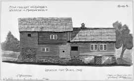
- Remove Museum filter Museum
- Remove Thrust sheets filter Thrust sheets
- Remove Cultural landscapes filter Cultural landscapes
- Remove Large landforms filter Large landforms
- Remove Road constructions filter Road constructions

Rallarvegen
They rest there, all as one, the silent witnesses of Western Norway's saga of creation: Precambrian basement, phyllite and thrust sheet. In the end came the glaciers and sculptured the vast landscape. Along the ground or on the horizon, from bicycle or on foot - the landscape tells its story - and it tells it clearer on Rallarvegen than many other places.

Botnen
Fyksesundet and Botnagrenda present a fine experience of the landscape and cultural history; a geographically isolated local settlement with extensive cultural contact with the outside world.

Kvamskogen
The different bedrock types that got shoved in over Hordaland in Cambro-Silurian times still remain, layer by layer, almost like a cake. But at Kvamskogen the cake has been turned upside down.

Nes
The farm Nes lies directly inside Mundheim on a forested headland in the fjord between Mundheimsvika and Bondesundet, a farm with an attractive and well-kept cultural landscape.

Tokagjelet
There is a sharp transition between the wide valley at Kvamskogen and the narrow Tokagjelet. The transition is no less dramatic when we come out of the crooked tunnels far down in the canyon, and the open Steinsdalen valley spreads out before us. The canyon both separates and joins together different epochs in western Norway's history.

Vesoldo
Folds are to be found everywhere in the remains of the Caledonian mountain chain. Some were formed during the collision with Greenland, others stem from the time when the mountain chain collapsed. Few can compare with the giant fold that remains in the mountain area around Tørvikenuten, Vesoldo and Hellefjellet.


Dyrskard
Right from the start the road across Haukelifjell was a road from “fjord to fjord”, from the bottom of Sørfjorden to Dalen in Telemark. The connection between Røldal-Haukelifjell was considered so important by Stortinget (Parliament) that the road construction Odda-Dalen was approved already in 1853.

Reinsnos
The mountain settlement Reinsnos is situated at nearly 700 metres above sea level at the end of the Reinsnos lake; an entry point to the Hardanger plateau.

