- Remove Small landforms filter Small landforms
- Remove Place filter Place
- Remove Sediments filter Sediments
- Remove Music filter Music
- Remove Basement rocks filter Basement rocks
- Remove Burial mounds filter Burial mounds
![Sketch showing the process of formation of an esker.](https://www.grind.no/sites/default/files/styles/medium/public/bilder/sted/232/skisse.jpg?itok=dTA78127)
![Moraine ridges, Fruo.](https://www.grind.no/sites/default/files/styles/medium/public/bilder/sted/232/eid_22a.jpg?itok=V9Vy57R6)
Fruo
At Fruo, nature has built its own little "Chinese wall ". Some kilometers south of the Vøringsfossen waterfall, there are a number of moraine ridges, the longest and most notable of their kind in Hordaland.
![Skytjedalen in Eidfjord.](https://www.grind.no/sites/default/files/styles/medium/public/bilder/sted/190/011.jpg?itok=YAgcsVmd)
![The Eidfjord terrace as seen from Lægreid, presumably in the early 1900s.](https://www.grind.no/sites/default/files/styles/medium/public/bilder/sted/232/eid_36.jpg?itok=_A8sZyMW)
Hæreid- geology
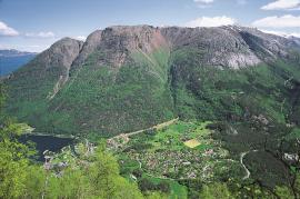
The Eidfjord terrace is a gigantic ridge that reaches up more than one hundred metres from the city centre in Eidfjord. It serves as a powerful natural monument left behind by the ice when it retreated.
![The quartz quarry in the mountainside above Kvalvikane](https://www.grind.no/sites/default/files/styles/medium/public/bilder/sted/232/ull_27.jpg?itok=zyI9-mbt)
Kvalvikane
In Ålvik quartz has long been used to produce ferro-silicon. The quartz was collected from the other side of the fjord, from the mountainside above Kvalvikane.
![From Helland toward the end of the valley with the Skrikjo waterfall.](https://www.grind.no/sites/default/files/styles/medium/public/bilder/sted/232/ull_11.jpg?itok=aQL9hvnj)
![Housing development Huse in Kinsarvik.](https://www.grind.no/sites/default/files/styles/medium/public/bilder/sted/232/ull_36.jpg?itok=EzDbFhGl)
![Sculptures in the bedrock](https://www.grind.no/sites/default/files/styles/medium/public/bilder/sted/232/jondal_23.jpg?itok=fS00QTt-)
![The contrast between phyllite and Precambrian basement is clearly visible at Lussand.](https://www.grind.no/sites/default/files/styles/medium/public/bilder/sted/232/gra_27.jpg?itok=knbu7uIk)
Lussand- geology
Hardangerfjorden kløyver Hordaland i to. Den etter måten rettlinja fjorden skjer seg liksom på skeive inn i landet. Ikkje som Sognefjorden og Nordfjord – dei krokar og buktar seg innover meir eller mindre vinkelrett på kysten. Hardangerfjordens utforming har røter 400 millionar år tilbake i tida, då den veike sona i fjellet, der isen seinare tok grådig for seg, vart danna. Denne sona stig på land ved Lussand.