- Remove Small landforms filter Small landforms
- Remove Glaciers filter Glaciers
- Remove Middle age filter Middle age
- Remove Maritime environments filter Maritime environments
- Remove People and Society filter People and Society
- Remove Defense filter Defense
- Remove Place filter Place
- Remove Livelihood and Craftsmanship filter Livelihood and Craftsmanship
- Remove Road constructions filter Road constructions
- Remove Landscape filter Landscape
- Remove Farm sites filter Farm sites


Skorpo
Skorpo - Polished by glaciers and meltwater

Bondhusdalen
The Bondhus area in Maruanger has been a magnet for tourists ever since the stream of tourists to Norway's west coast began in the middle of the 1800s. The magnificent landscape with the "ice trail" up to Bondhusvatnet Lake, the ice falls from Bondhusbreen glacier and Keisarstigen trail up to Folgefonna are still popular tourist attractions.

Mosnes
The permanently-protected Mosneselva River, with its meltwater from Folgefonna, runs out into Åkra Fjord by the roadless and uninhabited Mosnes. Those who once lived here were forced to surrender to the ravages of Nature. In the autumn of 1962 there was a flood so great that the people were driven from their farms.

Staup
The farm STAUP lies on a shelf in the terrain above Løno. From the highway E16 it is possible to glimpse the houses through the trees. The farm is without a road, and the old farmyard and the cultural landscape is very well preserved. In the 1980s grants were given to carry out maintenance work with the intention of protecting the houses in the farmyard.

Berge
Down by the fjord on the farm Berge in Tørvikbygd, is Stekkavika – a sheltered eastward facing harbour, protected against the fjord by headlands and rocks, even manifest in the name. Here is also a comprehensive milieu of coastal industry, with boathouses and sea-sheds that belong to the farms Berge, Heradstveit and Halleråker. Belonging to the farm Berge there is also a mill-house, circular saw, workshop for sloop building, and – a little further up into the woods – the old water-powered sash-saw.

Tælavåg
Tælavåg has a significant place in the history of the German occupation in WWII. The small community by the sea, where for centuries people had made a living from farming and fishing in harmony with the natural resources, in 1942 became the victim of German reprisals without their equal in Norwegian war history. The collection of war histories in Tælavåg provides us with a close-up of the dramatic events.

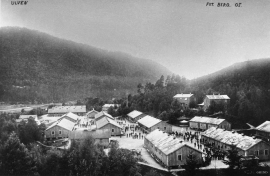
Herdla farm
Numerous finds show that the settlement at Herdla goes back to prehistoric times, and the large estate at Herdla has enjoyed a central place in the nation’s history since High Middle Ages. As Ask, Herdla was part of the country estate Harald Hårfagre took over as he took command of the west of Norway.

