- Remove Smallholdings filter Smallholdings
- Remove Tourism filter Tourism
- Remove Burial mounds filter Burial mounds
- Remove Late glacial filter Late glacial
- Remove Mountain plants filter Mountain plants
- Remove Faults filter Faults

Skånevik- moraine
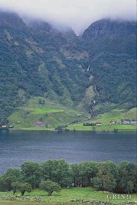
In Skånevik there are marks left from the ice edge that advanced during the thousand-year cold spell (Younger Dryas) that marked the end of the Ice Age roughly 11 500 years ago. The glacier first proceeded out into Åkra Fjordand and around Vannes and thereafter sent an arm in toward Skånevik. Here, the glacier lay down an end moraine up against the mountainside.

Krokavatnet
On Sunday the 29th of January, 1989, at 17:38 o'clock, Etna shook. The earthquake, with its epicentre ca. 9 kilometres south of Etne centre, had a strength of 4.2 on the Richters scale. This could be felt over large parts of West Land, especially in the areas around Åkra, Etne, Hardanger Fjord and Sauda Fjord. The earthquake was the largest that has ever been measured in Hordaland.


Melderskin
MELDERSKIN - ONCE A NUNATAK? Melderskin, the towering and majestic landmark at Rosendal, rises 1462 metres above sea level. The top area is smooth, but slightly inclined. Geologists think that the area is a remnant of a weakly undulating landscape, that originated near the sea, long before the Ice Age set in.
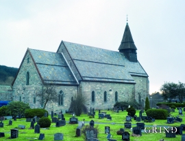
Fana church
In the Middle Ages the stone church in Fana was a place for pilgrimage, containing a miraculous silver crucifix that could heal the sick. A hill to the west of the church is still called Krykkjehaugen (the crutch hill); according to belief this is where the sick threw away their crutches. Perhaps this church, lying where it does at the old half county boundary , also held a special position in relation to the district churches in the county.

