- Remove Basement rocks filter Basement rocks
- Remove Midthordland filter Midthordland
- Remove Archaeological findings filter Archaeological findings
- Remove Conservation area filter Conservation area
- Remove Metamorphic rocks filter Metamorphic rocks
- Remove Sunnhordland filter Sunnhordland
- Remove Large landforms filter Large landforms
- Remove Civil servant dwellings and manors filter Civil servant dwellings and manors

Sandviksfjellet
On Sandviksfjellet there are old boulders that have been made into mountains. The stones have been stretched out or squeezed together between huge slabs of rock, during slow, but powerfulprocesses of transport. This conglomerate shows, in quite a special way, the enormous powers that were active during the collision between Norway and Greenland over 400 million years ago.

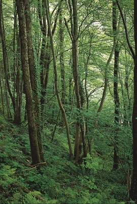
Isdalen
The valley on the inside of the Svartediks dam, a five minutes' bus ride from Bergen centre, is often referred to by Bergen folk as Isdalen ("Ice Valley") - justifiably, since the area could have been described in textbooks for its ice-carved land forms. The glacier's polishing over ca. 40 ice ages has created a magnificient landscape. The original ice valley climbs up behind Ulriken at the end of Svartediket.

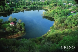
Rambjøra
In Sanddalen and Helldalsåsen the building of houses has increased dramatically. Where there eariery was grazing land, hundreds of families now live. Not far away, lies Rambjøra as an oasis in the built up area.
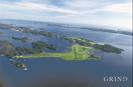
Herdla- Migrating birds
Bergen folk landed on it, long and well. The Germans took it over, during the Second World War. The birds had been doing it for several thousands of years: HERDLA is the main airport for migrating birds during their autumn migrations.
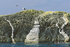
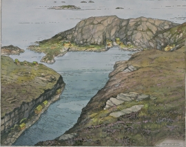
Møkstrafjordøyane
The sea keeps the bedrock in the outer skerries smooth and clean. When the bedrock is also varied and interesting, the setting is perfect for a discovery tour of these bare-faced outcrops.

Melderskin
MELDERSKIN - ONCE A NUNATAK? Melderskin, the towering and majestic landmark at Rosendal, rises 1462 metres above sea level. The top area is smooth, but slightly inclined. Geologists think that the area is a remnant of a weakly undulating landscape, that originated near the sea, long before the Ice Age set in.

