- Remove Cultural landscapes filter Cultural landscapes
- Remove Samnanger filter Samnanger
- Remove Voss, frå 2020 del av nye Voss herad. filter Voss, frå 2020 del av nye Voss herad.
- Remove Archaeological findings filter Archaeological findings
- Remove Chieftains and royal lines filter Chieftains and royal lines
- Remove Lakes, rivers and river networks filter Lakes, rivers and river networks
- Remove Jondal, frå 2020 del av nye Ullensvang kommune. filter Jondal, frå 2020 del av nye Ullensvang kommune.
- Remove Coniferous forests filter Coniferous forests
- Remove Thrust sheets filter Thrust sheets

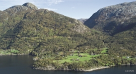
Hereiane
At Hereiane on warm summer days one you can walk barefoot up the hill from the fjord all the way up to 400 metres elevation. The naked, furrowed bedrock often causes travellers who see it from the north side of the fjord to wonder. Why does it look like this, and why is there so little that grows here? It is a long way to the heavy metal industry in Ålvik and Odda, and there hasn’t been a forest fire in modern times.
Torsnes
When bishop J.Neumann was on a visitation in Hardanger in 1825 he also visited Torsnes, the seat of the Galtung family. They were then in the process of pulling down the old dwelling house on the farm. As the committed observer of ancient monuments and antiquarian buildings that he was, bishop Neumann has provided us with interesting details:

Fossen Bratte
The steep drop by Fossen cliff has been the biggest challenge for those who wished to make a road over Kvamskogen through the years. Leave the car by the monument on the old road and take a walk down to the bend by the waterfall that Bergen-folk call "The bridal veil". Why is there a waterfall just here?

Frøland
Much rain, a steep drop and nearness to Bergen meant that the power-making potential of the Samnanger water system was exploited early. Samnanger was thus one of the first power-producing municipalities in western Norway. With its subsequent expansion and new power stations, about 400 gigawatts of electricity per hour were produced on average each year. This is enough to meet the energy needs of 25,000 households.


Gullbotnen
A barren belt where almost nothing grows, runs through the forest on the east slope of Gullbotnen. But, along the west side of the main road there is a fertile zone that flourishes with several finicky plant types. The contrasts arise from the extreme variations in the nutrient content of the bedrock.


Byrkjehaugen
On the farm Bø, close to the highway between Bulken and Voss lies Byrkjehaugen, one of the largest burial mounds in West Norway. Originally it was around 50m across and 5m high, but following the excavation in 1908 and chipping off by both railway and road construction, the cross-section has shrunk to 37m and the height to 4m. All the same, it is an impressive burial monument for the passing traveller to see.

Hamlagrø
The type of underlying rock can be decisive for how many different types of plants are found in an area. In the area around Hamlagrø-lake the diversity is especially obvious. The geological conditions change much here within a short distance.

