- Remove Cultural landscapes filter Cultural landscapes
- Remove Samnanger filter Samnanger
- Remove Voss, frå 2020 del av nye Voss herad. filter Voss, frå 2020 del av nye Voss herad.
- Remove Archaeological findings filter Archaeological findings
- Remove Literature filter Literature
- Remove Rock carvings filter Rock carvings
- Remove Conservation area filter Conservation area
- Remove Granvin, frå 2020 del av nye Voss herad filter Granvin, frå 2020 del av nye Voss herad
- Remove Lakes, rivers and river networks filter Lakes, rivers and river networks

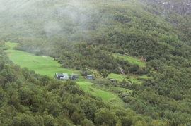
Granvinsvassdraget
After the ice age, Granvin Fjord reached all the way up under Skjervsfjossen waterfall. Just a thousand years later, as a result of the rising of the land after the ice melted, this whole inner part of the fjord freed itself of the sea and became Granvinsvatnet lake. In spite of this rise in elevation, this waterway is still navigable for fish: Sea trout have wandered into Granvinsvatnet in more recent times and evolved to become freshwater trout. And salmon and sea trout made the journey 13 kilometres up the Storelvi river.

Joberget
Flowering lime is one of nature's blessings: The nectar gives clear honey. The flower is used as folk medicine. From the inner bark of the lime tree one can make strong rope. Elderly folk can still tell how they got a weather report from the lime tree. If it smelled strong, it was probably going to rain. Lime often grows together with elm, ash and other tree species of the deciduous forest. Pure lime forests are rarer. Granvin has Hordaland's biggest lime forests.


Uranes
One of the most magnificent deciduous forests in Hordaland grows along the border with Kvam. The rich growth comes from the phyllite and mica schist bedrock, together with a good climate. Along the fjord the summer is warm but not too dry, and in winter it is not too cold for plants that do not tolerate the frost.

Fossen Bratte
The steep drop by Fossen cliff has been the biggest challenge for those who wished to make a road over Kvamskogen through the years. Leave the car by the monument on the old road and take a walk down to the bend by the waterfall that Bergen-folk call "The bridal veil". Why is there a waterfall just here?

Frøland
Much rain, a steep drop and nearness to Bergen meant that the power-making potential of the Samnanger water system was exploited early. Samnanger was thus one of the first power-producing municipalities in western Norway. With its subsequent expansion and new power stations, about 400 gigawatts of electricity per hour were produced on average each year. This is enough to meet the energy needs of 25,000 households.


Byrkjehaugen
On the farm Bø, close to the highway between Bulken and Voss lies Byrkjehaugen, one of the largest burial mounds in West Norway. Originally it was around 50m across and 5m high, but following the excavation in 1908 and chipping off by both railway and road construction, the cross-section has shrunk to 37m and the height to 4m. All the same, it is an impressive burial monument for the passing traveller to see.


