- Remove Smallholdings filter Smallholdings
- Remove Burial mounds filter Burial mounds
- Remove Etne filter Etne
- Remove Stone crosses filter Stone crosses
- Remove Eidfjord filter Eidfjord
- Remove Voss, frå 2020 del av nye Voss herad. filter Voss, frå 2020 del av nye Voss herad.
- Remove Glaciers filter Glaciers

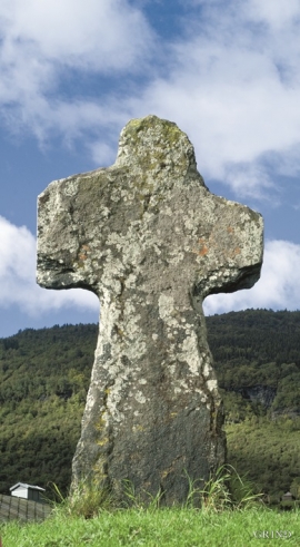
Hæreid- archaeology
The biggest prehistoric burial site in Hordaland is situated at Hæreid. On top of the terrace expanse, inside the fine birch garden, is where they lie, the mounds and stone piles, on their own or in clusters, large and small, round and elongated – at least 350 in all.

Simadalen
On the 10th of August, 1937, over half of the agricultural land in Simadalen was submerged by the river. The damage to roads and houses was also catastrophic. This was the most destructive flood ever recorded in Hordaland.


Grindheim church
The first church at Grindheim was a stave church with a free-standing steeple. The church was first mentioned in 1326, but was probably built long before this time.

Byrkjehaugen
On the farm Bø, close to the highway between Bulken and Voss lies Byrkjehaugen, one of the largest burial mounds in West Norway. Originally it was around 50m across and 5m high, but following the excavation in 1908 and chipping off by both railway and road construction, the cross-section has shrunk to 37m and the height to 4m. All the same, it is an impressive burial monument for the passing traveller to see.


Mosnes
The permanently-protected Mosneselva River, with its meltwater from Folgefonna, runs out into Åkra Fjord by the roadless and uninhabited Mosnes. Those who once lived here were forced to surrender to the ravages of Nature. In the autumn of 1962 there was a flood so great that the people were driven from their farms.

