- Remove Smallholdings filter Smallholdings
- Remove Civil servant dwellings and manors filter Civil servant dwellings and manors
- Remove Sedimentary rocks filter Sedimentary rocks
- Remove Bedrock filter Bedrock
- Remove Basement rocks filter Basement rocks
- Remove Settlements, Villages, Towns filter Settlements, Villages, Towns

Ingahogg
At nearly 1000 metres over sea level, on the north side of INGAHOGG mountain, the remains of a soapstone quarry have been discovered. It is said, according to the Sagas, that Inga collected the big soapstone that lies in front of the Åkra Church from here.
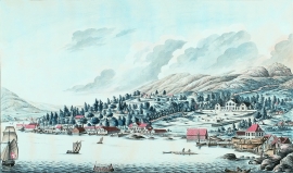
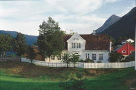
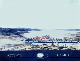
Damsgård
As a fairytale castle Damsgård Hovedgård lies on the slope rising up from the Puddefjord. The old connection between the farm and the sea, as we see it on Dreier’s prospectus from 1810, has been broken up by roads and encroachments in the building mass. But the main building itself is a central monument in Norwegian architecture from the 1700s – one of the finest representatives for the rococo period, with a magnificent and rich décor both in its interior and exterior.
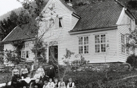
Stend
Garden Stend høyrde i mellomalderen til Nonneseter kloster. Etter reformasjonen var han i eiga til Vincents Lunge fram til 1680. Då overtok generaltollforvaltar Hans Christophersøn Hiorth eigedommen. Hiorth vart adla i 1682, og Stend fekk status som adeleg setegard. Truleg fekk den staselege hovudbygningen si form i Hiorths embetstid.
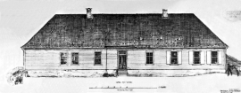
Engevik
Halfway into the Sævareidfjord lies the officer’s farm Engevik. In the beginning of the 1700s the farm was in part estate of the crown and owned by farmers. In 1724 lieutenant-colonel Christian Wilhelm Segelcke settled there and erected a new farm around an imposing main building a little way north of the old farm site.


Lussand- geology
Hardangerfjorden kløyver Hordaland i to. Den etter måten rettlinja fjorden skjer seg liksom på skeive inn i landet. Ikkje som Sognefjorden og Nordfjord – dei krokar og buktar seg innover meir eller mindre vinkelrett på kysten. Hardangerfjordens utforming har røter 400 millionar år tilbake i tida, då den veike sona i fjellet, der isen seinare tok grådig for seg, vart danna. Denne sona stig på land ved Lussand.

Trail toward Kyrkjedøri
Roughly 550 million years ago, what is now Finse lay at the bottom of the sea - the remains of mud and clay that were deposited in this sea have ended up on the roofs of Norway. Also the thrust sheet from the continental collision has found its way to Finse, after a several hundred kilometre-long, trek through the mountains, that took several tens of millions of years to complete.


