- Remove Smallholdings filter Smallholdings
- Remove Fish filter Fish
- Remove Waterfalls filter Waterfalls
- Remove Lakes, rivers and river networks filter Lakes, rivers and river networks
- Remove Sedimentary rocks filter Sedimentary rocks
- Remove Burial mounds filter Burial mounds
- Remove Chieftains and royal lines filter Chieftains and royal lines
- Remove Hardanger og Voss filter Hardanger og Voss
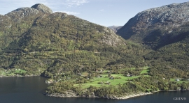
Torsnes
When bishop J.Neumann was on a visitation in Hardanger in 1825 he also visited Torsnes, the seat of the Galtung family. They were then in the process of pulling down the old dwelling house on the farm. As the committed observer of ancient monuments and antiquarian buildings that he was, bishop Neumann has provided us with interesting details:

Hæreid- archaeology
The biggest prehistoric burial site in Hordaland is situated at Hæreid. On top of the terrace expanse, inside the fine birch garden, is where they lie, the mounds and stone piles, on their own or in clusters, large and small, round and elongated – at least 350 in all.

Krækkjavassdraget
Few other animal species on Hardangervidda have been as much the focus of scientific research as the spotted trout. The spotted trout is considered to be a genetic variant of brown trout. It lives in parts of the Krækkjav water system. Otherwise, on a world scale, this species is only found in a small area in Kaukasus, and possibly also in a lake in Rondane.

Måbødalen- geology
The old pack road had 1500 steps, where cars today gas through the mountain. The time of this hard work is over, and of getting used to the steep terrain, as well; only the view from the top is much the same as before. Vøringsfossen in summer is one of Western Norway’s biggest natural wonders. It marks the transition between the older, open part of the Sysendalen valley and the younger, narrow and winding valley of Måbødalen.

Simadalen
On the 10th of August, 1937, over half of the agricultural land in Simadalen was submerged by the river. The damage to roads and houses was also catastrophic. This was the most destructive flood ever recorded in Hordaland.


Granvinsvassdraget
After the ice age, Granvin Fjord reached all the way up under Skjervsfjossen waterfall. Just a thousand years later, as a result of the rising of the land after the ice melted, this whole inner part of the fjord freed itself of the sea and became Granvinsvatnet lake. In spite of this rise in elevation, this waterway is still navigable for fish: Sea trout have wandered into Granvinsvatnet in more recent times and evolved to become freshwater trout. And salmon and sea trout made the journey 13 kilometres up the Storelvi river.

Solskinstjørni
Solskinstjørni in Osa, just above Haugen farm in Norddalen, is visible only now and again, seemingly always for a period of good weather. Then it disappears abruptly, but its disappearance is not connected to weather conditions.


