- Remove Smallholdings filter Smallholdings
- Remove Large landforms filter Large landforms
- Remove Maritime environments filter Maritime environments
- Remove Avalanches and rock falls filter Avalanches and rock falls
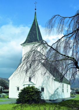
- Remove Churches filter Churches
- Remove Eidfjord filter Eidfjord
- Remove Hydro power filter Hydro power
- Remove Etne filter Etne
- Remove Meland, frå 2020 del av nye Alver kommune. filter Meland, frå 2020 del av nye Alver kommune.
- Remove Late glacial filter Late glacial
- Remove Stord filter Stord

Fruo
At Fruo, nature has built its own little "Chinese wall ". Some kilometers south of the Vøringsfossen waterfall, there are a number of moraine ridges, the longest and most notable of their kind in Hordaland.

Hæreid- geology
The Eidfjord terrace is a gigantic ridge that reaches up more than one hundred metres from the city centre in Eidfjord. It serves as a powerful natural monument left behind by the ice when it retreated.


Måbødalen- geology
The old pack road had 1500 steps, where cars today gas through the mountain. The time of this hard work is over, and of getting used to the steep terrain, as well; only the view from the top is much the same as before. Vøringsfossen in summer is one of Western Norway’s biggest natural wonders. It marks the transition between the older, open part of the Sysendalen valley and the younger, narrow and winding valley of Måbødalen.


Eldsfjellet
The eclogites in western Norway were formed when Precambrian basement rocks were squeezed and pressed down under great pressure deep under the Caledonian mountain chain. The process may well have triggered some of the deepest earthquakes the world has ever known. The clearest traces of this drama are found in and around Mt. Eldsfjellet, in peaceful Meland.

Holmeknappen
If you come by sea to Bergen and come up the Herdle Fjord, the yellow ochre marine shed at Holmeknappen is a well known landmark to starboard as you come close to the little shore settlement. In olden days Holmenknappen served important functions as a centre for a wide hinterland of the surrounding farms, warehouse, landing point, country store and later a steamer quay, a hotel (1896) and a dairy (1909). But today Holmeknappen is no longer a focal point. Transport and commercial routes have changed the old pattern

The village of Etne
Much of the sand and gravel that the town of Etne is built on was laid down at the end of the Ice Age and is evidence of melting glaciers and roaring meltwater rivers. The uncompacted material in the big terraces leave their unmistakeable mark on the wide elongated valleys.