- Remove Vernacular arts filter Vernacular arts
- Remove Iron age filter Iron age
- Remove Farm sites filter Farm sites
- Remove Place filter Place
- Remove Sveio filter Sveio
- Remove Øygarden, frå 2020 del av nye Øygarden kommune. filter Øygarden, frå 2020 del av nye Øygarden kommune.
- Remove Vaksdal filter Vaksdal
- Remove Hydro power filter Hydro power

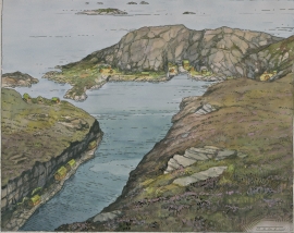
Toftestallen
The large coastal waves that crash down on the islands west in the sea gather their energy from storms and winds all the way out in the North Atlantic Ocean. The most common place of origin is nonetheless the North Sea. When these waves break over the skerries and islets along the shore, or on the rocky outermost islands, their energy is released. This takes the form of turbulence in the water and sea spray up on land. Can the enormous energy contained in the waves be exploited?

Dale farm
The Dale farm lies well situated on the gravel by the river, below the mountain Beitelen. But a few stone throws further north, on the wide expanse behind the houses, there has been an older farmstead. Here there have been found a number of cooking hollows, pole holes, an old road and traces of something believed to have been a palisade. Finds from this oldest farmstead may be dated to the time of the migrations, 400-600 years A.D.

Dale power station
In 1923 Bergenshalvøens Kommunale Kraftselskap (BKK) expropriated large areas for power plants and development of hydropower started soon afterwards. Dale power station with the two first aggregates, each of 14 MW was put into operation on 17 November 1927. In the supply reservoir in Storefossen 5152 cubic metres of concrete were cast, and a modern and well-equipped power station was built.

Eksingedalen- hydropower development
Water discharge at the outlet of the Ekso into Eidsfjord was halved after the big hydropower development in the mountainous area between Modalen and Eksingedalen and further southward toward Evanger in the 1960s, 70s and 80s. In an attempt to amend the changed environmental conditions in the waterway the developer built 35 small dams in the river.


Gullbrå
From written sources we know that the farm Gullbrå was in use early in the 1600s. The Apostolic church in Bergen owned land here that it rented out, but even early in the 1600s some of the land was in private ownership. Eksingedalen then belonged to Modalen parish, which was under Hamre parish. In 1723 the Apostolic church still had properties here, and Ivar and Lars were farmers.

Einstapevoll- the farm
Einstapevoll (from einstape: “bregne” (fern)) lies on the west side of the Tittelsnes peninsula. Up to 1831 the farm was a vicarage belonging to Stord parish. The priests had leasing rights. Land rent and other fees from the farm was part of their salaries.

Haugsbø
The single unit farm without a road to it, Haugsbø, is situated on the east side of the Tittelsnes peninsula facing Ålfjorden. As far back as the Middle Ages the farm has probably belonged to Stord Parish, up to the 1800s. In 1590 it was thought to be abandoned, but in 1601 Mickel Hougsbøe paid a tithe on the farm.
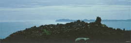
Tjernagel
For almost three thousand years Tjernagelshaugen (the Tjernagel cairn) has lain as a landmark at the Bømlo fjord. The poet Torarin mentions the cairn in his account of Knut the Mighty, who in the year of 1028 sailed from Denmark to Nidaros: “And in front of the old cairn at Tjernagel sailed soldiers sharp with peace”.