- Remove Small landforms filter Small landforms
- Remove Cultural landscapes filter Cultural landscapes
- Remove Conservation area filter Conservation area
- Remove Waterfalls filter Waterfalls
- Remove Askøy filter Askøy
- Remove Voss, frå 2020 del av nye Voss herad. filter Voss, frå 2020 del av nye Voss herad.
- Remove Eidfjord filter Eidfjord
- Remove Ullensvang, frå 2020 del av nye Ullensvang kommune. filter Ullensvang, frå 2020 del av nye Ullensvang kommune.

Holo
I Kvassdalen var det aktiv stølsdrift med mjølking av kyr og geitehald nokre år inn i vårt tusenår, og slik hadde det vore i meir enn to hundre år. Såleis har dalen ikkje fått gro til med kratt og skog, men er open og lys. Fortsett er det beiting av kyr og sauer.

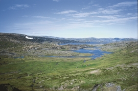
Langavassmyrane
The Ruff lek on Langvassmyrane is the only known phenomenon of its kind on Hardangervidda. Every year it attracts hens from the whole plateau. The marsh is also the richest wetland in the county. This green oasis is located in a rocky moraine landscape a few hours walking distance south of Dyranut.

Bjoreidalen
Bjoreidalen is one of the classic bird localities on Hardangervidda. It is especially known for its wading birds, with as many as 17 of the 19 wader species that nest in Hordaland.

Måbødalen- geology
The old pack road had 1500 steps, where cars today gas through the mountain. The time of this hard work is over, and of getting used to the steep terrain, as well; only the view from the top is much the same as before. Vøringsfossen in summer is one of Western Norway’s biggest natural wonders. It marks the transition between the older, open part of the Sysendalen valley and the younger, narrow and winding valley of Måbødalen.

Veivatnet
From Kinsekvelven river and inward to Lake Veivatnet, we can wander through one of Hardangervidda's many fertile areas. A number of finicky plants grow here, and there are plenty of birds and fish. We can thank a lime rich soil for the diversity.


Rekvesøyane
The sediment that was deposited from the river Dyrvo has created the fan-shaped delta Rekvesøyane. The bit of land farthest out toward the water gets periodically flooded, especially during snow melt and after periods of much rain.

Bordalsgjelet
Deep down between the stone polished phyllite bedrock in Bordalsgjelet canyon, there is a cascading river. In close cooperation with hard polishing stones, the water has carved into the bedrock for thousands of years - and is still doing so today.

