- Remove Small landforms filter Small landforms
- Remove Middle age filter Middle age
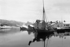
- Remove Maritime environments filter Maritime environments
- Remove Place filter Place
- Remove Nordhordland filter Nordhordland
- Remove Hardanger og Voss filter Hardanger og Voss
- Remove Vernacular crafts filter Vernacular crafts
- Remove Lakes, rivers and river networks filter Lakes, rivers and river networks
- Remove Trading posts and guesthouses filter Trading posts and guesthouses


Svåsand
Down by the fjord at Svåsand, close to the main highway, there is a long row of boathouses, one of the well-preserved, older boathouse locations along the Hardanger fjord. It is the farms at Svåsand that have their boathouses here, four main farms with origins far back in time.

Halne
At Halnefjorden, a few hundred metres east of Halne mountain lodge, lie the remains of two stone sheds – Halnelægeret. Some generations ago the cattle drovers stopped here in the summer; they were the cowboys of their time. But Halnelægeret already had a long history before the cattle drovers came.

Heggjagarden
The transport exchange on the farm Vik in Eidfjord was an important part of the communication network in older times. This is where people secured transport by boat out in the fjord, those travelling across the mountain from east and down into Måbødalen. The transport exchange was situated at “Wiige grund”. Today the highway cuts through the farmyard; the main farmhouse from the 1800s lies on the upper side of the road, the large sea-house, with a bakery in former times, lies close to the fjord.

Krækkjavassdraget
Few other animal species on Hardangervidda have been as much the focus of scientific research as the spotted trout. The spotted trout is considered to be a genetic variant of brown trout. It lives in parts of the Krækkjav water system. Otherwise, on a world scale, this species is only found in a small area in Kaukasus, and possibly also in a lake in Rondane.

Simadalen
On the 10th of August, 1937, over half of the agricultural land in Simadalen was submerged by the river. The damage to roads and houses was also catastrophic. This was the most destructive flood ever recorded in Hordaland.

Granvinsvassdraget
After the ice age, Granvin Fjord reached all the way up under Skjervsfjossen waterfall. Just a thousand years later, as a result of the rising of the land after the ice melted, this whole inner part of the fjord freed itself of the sea and became Granvinsvatnet lake. In spite of this rise in elevation, this waterway is still navigable for fish: Sea trout have wandered into Granvinsvatnet in more recent times and evolved to become freshwater trout. And salmon and sea trout made the journey 13 kilometres up the Storelvi river.


