- Remove Small landforms filter Small landforms
- Remove Thrust sheets filter Thrust sheets
- Remove Coniferous forests filter Coniferous forests
- Remove Sediments filter Sediments
- Remove Avalanches and rock falls filter Avalanches and rock falls
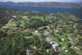
- Remove Trading posts and guesthouses filter Trading posts and guesthouses
- Remove Fish filter Fish
- Remove Bedrock filter Bedrock


Ølve- Mining
All in all there are ten known copper mines and two iron mines on the Ølve peninsula. Geologically, the nine mines on Varaldsøy Island also should be figured in. The industry began at Lilledal in 1642 wth the mining of iron ore. From Jernsmauget by Dyråsen, the iron ore was sent to the iron works in eastern Norway.


Lussand- geology
Hardangerfjorden kløyver Hordaland i to. Den etter måten rettlinja fjorden skjer seg liksom på skeive inn i landet. Ikkje som Sognefjorden og Nordfjord – dei krokar og buktar seg innover meir eller mindre vinkelrett på kysten. Hardangerfjordens utforming har røter 400 millionar år tilbake i tida, då den veike sona i fjellet, der isen seinare tok grådig for seg, vart danna. Denne sona stig på land ved Lussand.
Ask- jordbær
Strawberry-growing on Askøy flourished in the beginning of the last century. When gardener Samson Eik took in the type "Seierherren" from Rosendal in 1909 for growing strawberries on Hop, it appeared that the soil and climate in this area was perfect for the mass production of strawberries.


Gullbotnen
A barren belt where almost nothing grows, runs through the forest on the east slope of Gullbotnen. But, along the west side of the main road there is a fertile zone that flourishes with several finicky plant types. The contrasts arise from the extreme variations in the nutrient content of the bedrock.

