- Remove Small landforms filter Small landforms
- Remove Lakes, rivers and river networks filter Lakes, rivers and river networks
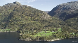
- Remove Voss, frå 2020 del av nye Voss herad. filter Voss, frå 2020 del av nye Voss herad.
- Remove Chieftains and royal lines filter Chieftains and royal lines
- Remove Kvinnherad filter Kvinnherad
- Remove Thrust sheets filter Thrust sheets
- Remove Meland, frå 2020 del av nye Alver kommune. filter Meland, frå 2020 del av nye Alver kommune.
- Remove Jondal, frå 2020 del av nye Ullensvang kommune. filter Jondal, frå 2020 del av nye Ullensvang kommune.


Skorpo
Skorpo - Polished by glaciers and meltwater

Ølve- Mining
All in all there are ten known copper mines and two iron mines on the Ølve peninsula. Geologically, the nine mines on Varaldsøy Island also should be figured in. The industry began at Lilledal in 1642 wth the mining of iron ore. From Jernsmauget by Dyråsen, the iron ore was sent to the iron works in eastern Norway.


Hereiane
At Hereiane on warm summer days one you can walk barefoot up the hill from the fjord all the way up to 400 metres elevation. The naked, furrowed bedrock often causes travellers who see it from the north side of the fjord to wonder. Why does it look like this, and why is there so little that grows here? It is a long way to the heavy metal industry in Ålvik and Odda, and there hasn’t been a forest fire in modern times.
Torsnes
When bishop J.Neumann was on a visitation in Hardanger in 1825 he also visited Torsnes, the seat of the Galtung family. They were then in the process of pulling down the old dwelling house on the farm. As the committed observer of ancient monuments and antiquarian buildings that he was, bishop Neumann has provided us with interesting details:

Eldsfjellet
The eclogites in western Norway were formed when Precambrian basement rocks were squeezed and pressed down under great pressure deep under the Caledonian mountain chain. The process may well have triggered some of the deepest earthquakes the world has ever known. The clearest traces of this drama are found in and around Mt. Eldsfjellet, in peaceful Meland.

Håøy
Håøy lies centrally in one of the main shipping lanes going into Bergen --- with Håyøsund on the south side facing Meland, and Hagelsundet facing Lindåslandet. Names like Nordfarskista and Nordfarsskorane explain things. The strategic position was important in Viking times and it has been important in our days too. The beacon on Håøy can have been built in the establishment of the coastal administration in Håkon the Good’s time, about 950 AD. The defence structure of which we say remains on Håøy Summit held a critical position during Norwegian neutrality during the First World War. The defence structure was taken down in 1957.

Bordalsgjelet
Deep down between the stone polished phyllite bedrock in Bordalsgjelet canyon, there is a cascading river. In close cooperation with hard polishing stones, the water has carved into the bedrock for thousands of years - and is still doing so today.

Hamlagrø
The type of underlying rock can be decisive for how many different types of plants are found in an area. In the area around Hamlagrø-lake the diversity is especially obvious. The geological conditions change much here within a short distance.

