- Remove Small landforms filter Small landforms
- Remove Eidfjord filter Eidfjord
- Remove Conservation area filter Conservation area
- Remove Lakes, rivers and river networks filter Lakes, rivers and river networks
- Remove Bømlo filter Bømlo
- Remove Introduced species filter Introduced species
- Remove Burial mounds filter Burial mounds
- Remove Thrust sheets filter Thrust sheets


Bjoreidalen
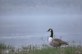
Bjoreidalen is one of the classic bird localities on Hardangervidda. It is especially known for its wading birds, with as many as 17 of the 19 wader species that nest in Hordaland.

Finnås
At Flintaneset by Finnåsvika, in the centre of the municipality, we find the most beautiful and best preserved igneous rocks in western Norway. We must go to Hawaii or Island to find as fine structures as at Bømlo.

Hæreid- archaeology
The biggest prehistoric burial site in Hordaland is situated at Hæreid. On top of the terrace expanse, inside the fine birch garden, is where they lie, the mounds and stone piles, on their own or in clusters, large and small, round and elongated – at least 350 in all.

Krækkjavassdraget
Few other animal species on Hardangervidda have been as much the focus of scientific research as the spotted trout. The spotted trout is considered to be a genetic variant of brown trout. It lives in parts of the Krækkjav water system. Otherwise, on a world scale, this species is only found in a small area in Kaukasus, and possibly also in a lake in Rondane.

Langavassmyrane
The Ruff lek on Langvassmyrane is the only known phenomenon of its kind on Hardangervidda. Every year it attracts hens from the whole plateau. The marsh is also the richest wetland in the county. This green oasis is located in a rocky moraine landscape a few hours walking distance south of Dyranut.

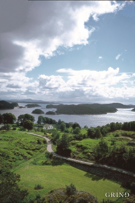
Siggjo
Siggjo is a cone-shaped, volcano-like mountaintop in the part of Hordaland where one finds the best preserved volcanic rocks. The rock types originate from one or several volcanoes that spewed out glowing lava and ash. But, the shape of the mountain, as it appears today, formed later and by completely different forces.

Simadalen
On the 10th of August, 1937, over half of the agricultural land in Simadalen was submerged by the river. The damage to roads and houses was also catastrophic. This was the most destructive flood ever recorded in Hordaland.

