- Remove Small landforms filter Small landforms
- Remove Cultural landscapes filter Cultural landscapes
- Remove People and Society filter People and Society
- Remove Fish filter Fish
- Remove Middle age filter Middle age
- Remove Road constructions filter Road constructions
- Remove Vernacular crafts filter Vernacular crafts
- Remove Voss (tidl. kommune) filter Voss (tidl. kommune)
- Remove Place filter Place
- Remove Settlements, Villages, Towns filter Settlements, Villages, Towns
- Remove Landscape filter Landscape
- Remove Sediments filter Sediments
- Remove Midthordland filter Midthordland

Arnatveit
On the farm of Arnatveit, high up on the slope above the highway, an old smokehouse remains standing in the courtyard of the main farm property, in the place of the old common courtyard. Today this farm lies at the outskirts of a large housing estate. Most of the farmland of the other farm properties has been sold to benefit the city’s need of sites for the new community of Arna.


Bolstad
The village at Bolstadøyri acquired its structure around the middle of the 1800s, but from the old days there has been a meeting place here; court location and trading post. The guesthouse place stems from the second half of the 17th century, and in the previous century Bolstadøyri was one of the largest rural trading posts in Nordhordland.

Bordalsgjelet
Deep down between the stone polished phyllite bedrock in Bordalsgjelet canyon, there is a cascading river. In close cooperation with hard polishing stones, the water has carved into the bedrock for thousands of years - and is still doing so today.

Bryggen
In the 1300s Bergen was a trading centre of European dimension. The town is thought to have had around 7000 inhabitants and was the largest and most important in the country. In a European context it was an average size town. At this time the most tightly built town area was still mostly east of Vågen from Holmen in the north to Vågsbotn in the south. Already in medieval times, latest in the 1340s, this area was called Bryggen.


Eikelandsosen
"So many and such big potholes as are found at Eikelandsosen, we don't see other places in western Norway, and as beautifully polished as the mountainside is along the river up to Koldal , one would look a long time to see anywhere else. There is much to dazzle a geologist's eyes. If only these features could bring others the same joy!"

Evanger
Evanger (from Old Norse ålvangr, “vang”, “voll” (field) where the horses may graze) is the place where the river from Vangsvatnet, the Voss watercourse, runs out into Evangervatnet. From here Teigdalen valley runs to the north, towards Eksingedalen, and from here there is a short distance to Bergsdalen in the south.
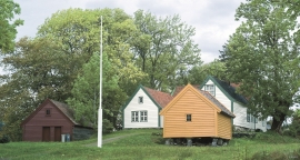
Ferstad
Ferstad is well worth a visit. The farm lies on a little hillock south of Lekven: a beautiful official residence from the 1700s.

Finne
Peter Bonde, who owned Finne towards the end of the 1200s, had a jumping stag in his family emblem. This stag is the origin for the heraldic blazon of Voss. Peter Bonde and his descendants acquired possession of many farms and farm parts; the so-called Finne properties became some of the largest land properties in the country.

