- Remove Modalen filter Modalen
- Remove Metamorphic rocks filter Metamorphic rocks
- Remove Lindås, frå 2020 del av nye Alver kommune. filter Lindås, frå 2020 del av nye Alver kommune.
- Remove Maritime environments filter Maritime environments
- Remove Nordhordland filter Nordhordland
- Remove Place filter Place
- Remove Vaksdal filter Vaksdal
- Remove Factories filter Factories
- Remove Farm sites filter Farm sites
- Remove Quarns and mills filter Quarns and mills
- Remove Late glacial filter Late glacial
- Remove Hydro power filter Hydro power

Bjørsvik
The industrial settlement Bjørsvik
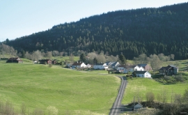
Isdal
Isdal one of the few clustered settlements left in the Hordaland communities, after the extensive changes taking place around the turn of the former century, which broke up the shared farms and the old intermixture of strips. The old, low houses are situated in a compact enclosure, which is very noticeable in the landscape when you travel the main road north from Knarrvik.


Mostraumen
Until 1743 the people from Modal had to wait for a flood in MOSTRAUMEN before they could draw their boats up the river current, and then row back across Lake Movatnet. But, that year the flood opened a free passageway all the way to Mo. Hordaland had gained a new tidal waterway.

Nedre Helland- Sand Quarries
The three spades in the municipal coat of arms for Modalen are sand spades. Sand quarrying has brought income and employment. As much as 70,000-80,0000 tonnes of sand and gravel left the municipality each year since the turn of the millennium, to be used as cementing sand. Why is Modalen endowed with so much sand?

Nottveit
In one of the frame-built haysheds at Nottveit, at holding No. 3, we discover that several of the staves have a medieval look, with large dimensions and carefully rounded edges. According to tradition, it was the farms Nottveit and Mostraumen that supplied the timber for the stave church at Mo, and it is not unlikely that these farms received the old timber in return when the new church was erected there in 1593.

Otterstad
Tthe Otterstad farms lie in the innermost part of Mofjorden, on the northwest side of the river. The row of stave-built boatsheds that belong to the farm were probably constructed a little after the middle of the 1800s. Both here and on the Mo side, the boatsheds were important storage places at the seashore; wood and other farm products intended for the town; corn and merchandise in return.

Stølsheimen
The large mountain area between Modalen, the Voss communities and Sogn is one of the finest mountain pasture areas in West Norway. In older times this area was called Steinslandsheimen, in our times it has acquired the name Stølsheimen. Power development and protection interests have been opposed here. The core area of Stølsheimen has now been protected as a landscape protection area, while some of the oldest mountain farms have been flooded. A register in the 1970s comprised almost 40 mountain farm settlements in the central area of Stølsheimen, belonging to Modalen, Høyanger and Vik municipalities.

Bergsdalen
The mountains of western Norway are lovely to wander in. In Cambro-Silurian time it was the mountain itself that wandered. The mountain, or more correctly the bedrock, first moved eastward, then back a bit westward again. All this rocking back and forth in the mountains ended about 400 million years ago.


