- Remove Arkeologi filter Arkeologi
- Remove Livelihood and Craftsmanship filter Livelihood and Craftsmanship
- Remove Sunnhordland filter Sunnhordland
- Remove Landscape filter Landscape
- Remove Bedrock filter Bedrock
- Remove Hardanger og Voss filter Hardanger og Voss

Ølve- Mining
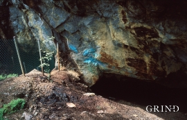
All in all there are ten known copper mines and two iron mines on the Ølve peninsula. Geologically, the nine mines on Varaldsøy Island also should be figured in. The industry began at Lilledal in 1642 wth the mining of iron ore. From Jernsmauget by Dyråsen, the iron ore was sent to the iron works in eastern Norway.

Ølve
Ølve has a special soil type. Here one finds an extra hard clay soil. This is especially noticed by those who work with excavating for building foundations and the like. Often it is necessary to use especially big digging machines and sometimes even dynamite in order to break up the compact masses. The reason for this is the growth of the glaciers toward the end of the Ice Age: The clay, that was first deposited in front of the glacier, came under great pressure when the glacier later grew and slid out over the clay.

Vøringsfossen
The official height of Vøringsfossen is 182 metres. A long time before modern measuring methods were invented, natural historians and other curious people tried to measure the height of the waterfall - using different methods - and with different results.

Vesoldo
Folds are to be found everywhere in the remains of the Caledonian mountain chain. Some were formed during the collision with Greenland, others stem from the time when the mountain chain collapsed. Few can compare with the giant fold that remains in the mountain area around Tørvikenuten, Vesoldo and Hellefjellet.


Valldalen
Valldalen or Valdalen, the name that the locals used in past times, had been a permanent settlement for a long time, and later the biggest mountain-farm valley in western Norway. Since that time there have been many changes: Most of the fields are no longer in use. Bjørkeskogen, a birch forest that had grown in the valley for thousands of years, took more and more over. And in the valley bottom, the Valldals dam now keeps the artificially large Valldalsvatnet Lake in place.

Urangsvågen-Rubbestadneset
In 1868 the first stone workers came to Rubbestadneset to take out the granite for the Skoltegrunns Pier, predecessor of the Skoltegrunns wharf in Bergen. Later granite was also taken out from the area, around Innværs Fjord and UransvågenN. The activity probably peaked around 1900, with over 40 men at work. 15 years later, it was finished.

Ulvik-village
The ice cap that covered the land during each of the 40 past ice ages over the past 2 million years of Earth's history pressed down the crust of the earth - like a finger on a rubber ball. And when the ice finally loosened its grip 11,000 years ago, the earth's crust rose again, most where the ice was thickest, least where it was thin, quickly in the beginning, and later more slowly. To this day, the land in the inner part of Norway continues to rise by perhaps one millimetre per year. By and large, however, the crust in Hordaland has again reached equilibrium after the weight of the ice was removed.

Ulvanosa
Some mountains have rounded shapes, while others have steep slopes and sharp edges. Ulvanosa (1246 mos.) has both. The forms reflect the type of bedrock below, and the forces that were in effect when they were formed.