- Remove Dialects and arts filter Dialects and arts
- Remove Settlements, Villages, Towns filter Settlements, Villages, Towns
- Remove Place filter Place

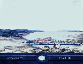
Salhus
Salhus has been a connecting point for sea travellers far back in time. The name probably derives from the Old Norse word sáluhús, “house for travellers”. The name may indicate that this was a place for an inn even in the Middle Ages. The place is eminently situated in the route to and from Bergen. For travellers coming by boat from Sogn and Nordhordland, Salhus is the last stop before Bergen. Travellers from the communities in Voss also came this way earlier when they were going to Bergen

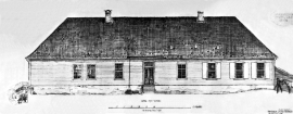
Stend
Garden Stend høyrde i mellomalderen til Nonneseter kloster. Etter reformasjonen var han i eiga til Vincents Lunge fram til 1680. Då overtok generaltollforvaltar Hans Christophersøn Hiorth eigedommen. Hiorth vart adla i 1682, og Stend fekk status som adeleg setegard. Truleg fekk den staselege hovudbygningen si form i Hiorths embetstid.

Strandsiden
During the 1300s Strandsiden changed from a rural area with a monastery to a pulsating trading centre with boathouses, storehouses and embankment.

Vågsbunnen
Vågsbotn was the name of the innermost part of the eastern part of town from Auta-almenning (today’s Vetrlidsalmenning), skirting the bottom of Vågen to Allehelgenskirken (All Saints’ Church) (at the present Allehelgensgate). In early medieval times Vågen reached almost all the way to Olavskirken (the Cathedral). It was a relatively wide bay inside the premonitory where Korskirken was built. The area was therefore much shorter than what is known as Vågsbunnen today.

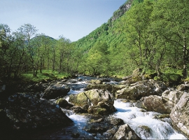
Stølsdalen
The grey alder forest down by the river in Stølsdalen is full of life. The many birds are very busy finding enough to eat from day to day – but the biggest challenge is to make oneself heard above the roar of the Stølselva River.

