- Remove Cultural landscapes filter Cultural landscapes
- Remove Samnanger filter Samnanger
- Remove Voss, frå 2020 del av nye Voss herad. filter Voss, frå 2020 del av nye Voss herad.
- Remove Archaeological findings filter Archaeological findings
- Remove Road constructions filter Road constructions
- Remove Os, frå 2020 del av nye Bjørnafjorden kommune filter Os, frå 2020 del av nye Bjørnafjorden kommune
- Remove Hydro power filter Hydro power
- Remove Øygarden, frå 2020 del av nye Øygarden kommune. filter Øygarden, frå 2020 del av nye Øygarden kommune.
- Remove Deciduous forests filter Deciduous forests
- Remove Rock carvings filter Rock carvings

Stalheimskleiva
From the oldest times on record in Norway one of the most important traffic arteries between west and east Norway has passed across Bolstad – Voss – Stalheim – Gudvangen and Lærdal. The post road between Oslo and Bergen was established here 1647, but in Stalheimskleiva there was only a packhorse track right up to the 1840s. Wheeled transport and carts were in little use in the mountains in West Norway up to that time.

Ulvund
One of the oldest farms in Myrkdalen, Ulvund, is recognized as one of 14 areas in Hordaland having an especially valuable cultural landscape. The dirt road runs along a steep slope down toward Lake Myrkdalsvatnet. The flattest field, which today is harvested for silage, used to be an old grain field, while the slopes were old hayfields.
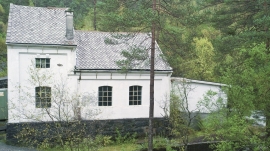
Ferstad
Ferstad is well worth a visit. The farm lies on a little hillock south of Lekven: a beautiful official residence from the 1700s.
Gåssand
The 28th November 1914 was a day to remember for the Os inhabitants. This was the day they could turn the switch on the wall and have electric light in their houses. It was like opening the door on the future when the power station at Gåssand was put into operation.

Grødalshaug
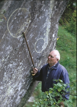
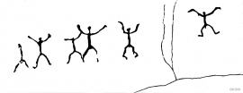
At the bottom of Vargavågen on Halhjem lies Grødalshaug, a 30 metres high rocky outcrop between the bay and a moist valley cleft. On the south side of the rock is a steep rock cliff facing the valley, the bog and the stream. On this rock face we find rock carvings from the Bronze Age.

Lysekloster- The monks and nature
Lysekloster was the largest agricultural property in the country when it was phased out during the Reformation in 1537. In its prime this cloister encompassed two-thirds of all the farms in Os. The monks introduced and cultivated new plant species and it was probably they who stocked the waters with fish not indigenous to the area. This legacy from the Middle Ages has left a lasting mark.

