- Remove Middle age filter Middle age
- Remove Mountain plants filter Mountain plants
- Remove Trading posts and guesthouses filter Trading posts and guesthouses
- Remove Maritime environments filter Maritime environments
- Remove Hardanger og Voss filter Hardanger og Voss
- Remove Boat- and shipyards filter Boat- and shipyards
- Remove Kvam filter Kvam
- Remove Osterøy filter Osterøy
- Remove Conservation area filter Conservation area
- Remove Waterfalls filter Waterfalls
- Remove Ullensvang, frå 2020 del av nye Ullensvang kommune. filter Ullensvang, frå 2020 del av nye Ullensvang kommune.
- Remove Burial mounds filter Burial mounds

Kinsarvik
Kinsarvik has probably been a centre for the inner Hardanger districts back in prehistory. History tells us that in medieval times there was a marketing place, a “kaupang”, here; a connecting point in the communications between east and west. There were supposedly around 300 residents here but the place was likely wiped out in a great fire.


Veivatnet
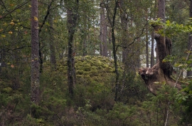
From Kinsekvelven river and inward to Lake Veivatnet, we can wander through one of Hardangervidda's many fertile areas. A number of finicky plants grow here, and there are plenty of birds and fish. We can thank a lime rich soil for the diversity.


Steinsdalsfossen
Øvsthusfossen, or Steinsdalsfossen waterfall, as it is called today, attracts tourists by the thousands, and always has done as long as there have been tourists in Norway, since the early 1800s.

Vesoldo
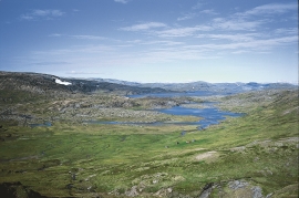
Folds are to be found everywhere in the remains of the Caledonian mountain chain. Some were formed during the collision with Greenland, others stem from the time when the mountain chain collapsed. Few can compare with the giant fold that remains in the mountain area around Tørvikenuten, Vesoldo and Hellefjellet.

Aga
The grand farm Aga on the west side of Sørfjorden, came under protection in 1937, when the agricultural reform threatened to disperse the old clustered settlement. “Lagmannsstova”, named after the “lagmann” (law speaker) Sigurd Brynjulfsson, was already protected in 1924; one of the authentic profane wooden buildings from the Middle Ages still standing. All the same it is the farmyard itself that is the key cultural monument.

