- Remove Smallholdings filter Smallholdings
- Remove Sedimentary rocks filter Sedimentary rocks
- Remove Music filter Music
- Remove Faults filter Faults
- Remove Late glacial filter Late glacial
- Remove Sediments filter Sediments
- Remove Trading posts and guesthouses filter Trading posts and guesthouses
- Remove Hardanger og Voss filter Hardanger og Voss

Fruo
At Fruo, nature has built its own little "Chinese wall ". Some kilometers south of the Vøringsfossen waterfall, there are a number of moraine ridges, the longest and most notable of their kind in Hordaland.

Hæreid- geology
The Eidfjord terrace is a gigantic ridge that reaches up more than one hundred metres from the city centre in Eidfjord. It serves as a powerful natural monument left behind by the ice when it retreated.

Heggjagarden
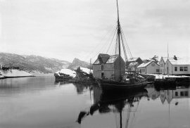
The transport exchange on the farm Vik in Eidfjord was an important part of the communication network in older times. This is where people secured transport by boat out in the fjord, those travelling across the mountain from east and down into Måbødalen. The transport exchange was situated at “Wiige grund”. Today the highway cuts through the farmyard; the main farmhouse from the 1800s lies on the upper side of the road, the large sea-house, with a bakery in former times, lies close to the fjord.


Kongstun
In the Middle Ages the farmers were under obligation to transport state officials. The bishops were entitled to 18 horses when they travelled about on visitations, and the king could requisition free transport.

Skjervet- river theft
At the end of the last ice age the ice flowed out of Hardanger fjord in such a fury that it forced the meltwater from Voss to run back uphill toward Granvin. The glacier from Raundalen down the windy valley along the Vosso to Bolstadøyri went too slow to make the turn.

Rallarvegen
They rest there, all as one, the silent witnesses of Western Norway's saga of creation: Precambrian basement, phyllite and thrust sheet. In the end came the glaciers and sculptured the vast landscape. Along the ground or on the horizon, from bicycle or on foot - the landscape tells its story - and it tells it clearer on Rallarvegen than many other places.

Trail toward Kyrkjedøri
Roughly 550 million years ago, what is now Finse lay at the bottom of the sea - the remains of mud and clay that were deposited in this sea have ended up on the roofs of Norway. Also the thrust sheet from the continental collision has found its way to Finse, after a several hundred kilometre-long, trek through the mountains, that took several tens of millions of years to complete.

Ulvik-village
The ice cap that covered the land during each of the 40 past ice ages over the past 2 million years of Earth's history pressed down the crust of the earth - like a finger on a rubber ball. And when the ice finally loosened its grip 11,000 years ago, the earth's crust rose again, most where the ice was thickest, least where it was thin, quickly in the beginning, and later more slowly. To this day, the land in the inner part of Norway continues to rise by perhaps one millimetre per year. By and large, however, the crust in Hordaland has again reached equilibrium after the weight of the ice was removed.

