- Remove Small landforms filter Small landforms
- Remove Fjell, frå 2020 del av nye Øygarden kommune filter Fjell, frå 2020 del av nye Øygarden kommune
- Remove Trading posts and guesthouses filter Trading posts and guesthouses
- Remove Maritime environments filter Maritime environments
- Remove Seabirds filter Seabirds
- Remove Monastery filter Monastery
- Remove Fitjar filter Fitjar
- Remove Ullensvang, frå 2020 del av nye Ullensvang kommune. filter Ullensvang, frå 2020 del av nye Ullensvang kommune.
- Remove Ulvik filter Ulvik
- Remove Basement rocks filter Basement rocks
- Remove Vernacular crafts filter Vernacular crafts
- Remove Aristocracy and civil servants filter Aristocracy and civil servants

Jomfrunuten
Freezing and thawing are processes that influence plant cover, move enormous blocks, stretche long mounds of earth, break open bedrock and create patterns in stone and earth.

Rallarvegen
They rest there, all as one, the silent witnesses of Western Norway's saga of creation: Precambrian basement, phyllite and thrust sheet. In the end came the glaciers and sculptured the vast landscape. Along the ground or on the horizon, from bicycle or on foot - the landscape tells its story - and it tells it clearer on Rallarvegen than many other places.

Brattholmen
The old guesthouse location in Brattholmen on the east side of Litlesotra, was probably established in the first half of the 1700s. A list from 1748 mentions that the place “for some years has been inhabited by an Enrolled Sailor by the name of Peder Michelsen”. As was the case for most other military hosts, he was exempt from paying income tax.

Haganes
The gneiss landscape west and north of Bergen viewed in profile can remind us of a saw blade of the kind that has long, slanted sides that get broken off shorter transverse sides. It has taken several hundred million years to file this saw blade, an enduring interplay between various geological processes.

Landro
Landro has been the largest estate on Sotra, including 15 farms with reasonable conditions for agriculture. Their boathouses have had an excellent harbour in Landrovågen. Landro thus has been a good basis for the combination of agriculture and fishing.

Langøy
Up to 1842 it was necessary to have a royal letter of privilege in order to carry out trade. According to the law only city dwellers were allowed to obtain such a privilege, and in Hordaland it was thus the citizens of Bergen who owned and ran the trading centres. In 1842, following a liberalisation of the trading legislation, the privilege arrangement was abandoned and anyone could apply to the municipal council for permission to carry out trading activity. Landøy is one of the places that were established in this period.

Løno
Small boat folk in Hordaland know where Løno is. As do many seabirds. With the big ocean at its back and a wide, weather beaten strait ahead of it, Løno is one of Hordaland’s most isolated and exposed recreational areas. The islands west of Sotra are some of the county’s most stable nesting localities for seabirds.

Engesund
For more than 350 years Engesund has been a place for hostelries and trading in the Fitjar islands. The place is centrally placed in the shipping lane, with a sheltered harbour close to the exposed Selbjørnsfjorden. Engesund was once part of the great network of historical stopover places on the coast.

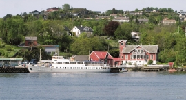
Færøysund
The old trading post lies at the sound between Stord and Færøy in Langenuen. There was a country store and steamship forwarding agent up to 1964. The trade was then moved over to the new ferry harbour of Sandvikvåg.

