- Remove Quarns and mills filter Quarns and mills
- Remove Basement rocks filter Basement rocks
- Remove Railroad filter Railroad
- Remove Mountain plants filter Mountain plants
- Remove Fish filter Fish
- Remove Late glacial filter Late glacial

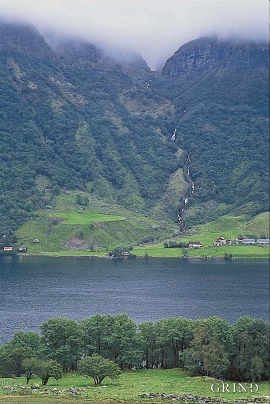
Kvalvikane
In Ålvik quartz has long been used to produce ferro-silicon. The quartz was collected from the other side of the fjord, from the mountainside above Kvalvikane.

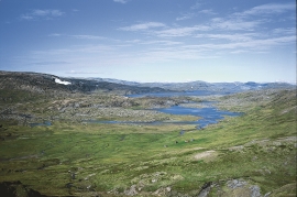
Veivatnet
From Kinsekvelven river and inward to Lake Veivatnet, we can wander through one of Hardangervidda's many fertile areas. A number of finicky plants grow here, and there are plenty of birds and fish. We can thank a lime rich soil for the diversity.

Lysekloster- The monks and nature
Lysekloster was the largest agricultural property in the country when it was phased out during the Reformation in 1537. In its prime this cloister encompassed two-thirds of all the farms in Os. The monks introduced and cultivated new plant species and it was probably they who stocked the waters with fish not indigenous to the area. This legacy from the Middle Ages has left a lasting mark.

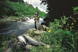
Oselva
Oselvo is the biggest waterway on the Bergen peninsula, with sources in Gullfjellet and Sveningen. There is a fall of only 60 metres along the entire stretch from Samdalsvatnet Lake to the sandbank in Fusafjorden. It is rare to see a river like this in western Norway. There is salmon along this entire section of the Oselvo river.


Skånevik- moraine
In Skånevik there are marks left from the ice edge that advanced during the thousand-year cold spell (Younger Dryas) that marked the end of the Ice Age roughly 11 500 years ago. The glacier first proceeded out into Åkra Fjordand and around Vannes and thereafter sent an arm in toward Skånevik. Here, the glacier lay down an end moraine up against the mountainside.