- Remove Smallholdings filter Smallholdings
- Remove Railroad filter Railroad
- Remove Igneous rocks filter Igneous rocks
- Remove Trading posts and guesthouses filter Trading posts and guesthouses
- Remove Waterfalls filter Waterfalls


Siggjo
Siggjo is a cone-shaped, volcano-like mountaintop in the part of Hordaland where one finds the best preserved volcanic rocks. The rock types originate from one or several volcanoes that spewed out glowing lava and ash. But, the shape of the mountain, as it appears today, formed later and by completely different forces.

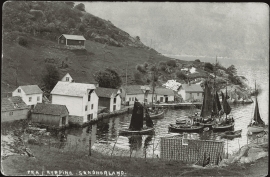
Urangsvågen-Rubbestadneset
In 1868 the first stone workers came to Rubbestadneset to take out the granite for the Skoltegrunns Pier, predecessor of the Skoltegrunns wharf in Bergen. Later granite was also taken out from the area, around Innværs Fjord and UransvågenN. The activity probably peaked around 1900, with over 40 men at work. 15 years later, it was finished.
Kyrping
The trading post down by the fjord at Kyrping does not belong to the oldest group of trading posts from the 1600s and 1700s. It was only after the liberalisation of the trading legislation that trade was established here.

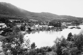
Skånevik- the trading post
There are only two buildings left of the old trading and guesthouse settlement in Skånevik. They are in the centre, close to the main road passing through the settlement. The other buildings that belonged to the place, the lodging house (“Holteriet”), the bakery, the courthouse, the boathouse and the sea house with the store, were pulled down in the last century.

Engesund
For more than 350 years Engesund has been a place for hostelries and trading in the Fitjar islands. The place is centrally placed in the shipping lane, with a sheltered harbour close to the exposed Selbjørnsfjorden. Engesund was once part of the great network of historical stopover places on the coast.

Færøysund
The old trading post lies at the sound between Stord and Færøy in Langenuen. There was a country store and steamship forwarding agent up to 1964. The trade was then moved over to the new ferry harbour of Sandvikvåg.

Fitjarøyane
If we study the group of islands south of Selbjørns Fjord from the air or on a sea map, we will notice that many of the islands are elongated and lie systematically in rows. The islands are divided by long sounds, for example Trollosen, Nuleia and Hjelmosen, which are oriented in a south-southeast to north-northwesterly direction.

Kattnakken–Stovegolvet
The highest mountainous area on Stord, including Kattnakken, Midtfjellet and Stovegolvet, has more in common with the mountainous terrain on the mainland than in the low coastal landscape of Sunnhordland. The volcanic bedrock together with the erosive powers of nature has resulted in a unique plateau landscape.

