- Remove Small landforms filter Small landforms
- Remove Fisheries filter Fisheries
- Remove Late glacial filter Late glacial
- Remove Place filter Place


Jomfrunuten
Freezing and thawing are processes that influence plant cover, move enormous blocks, stretche long mounds of earth, break open bedrock and create patterns in stone and earth.

Hæreid- geology
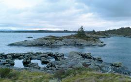
The Eidfjord terrace is a gigantic ridge that reaches up more than one hundred metres from the city centre in Eidfjord. It serves as a powerful natural monument left behind by the ice when it retreated.

Hystad- the black alder forest
One of the biggest black alder forests in the country is in Hystadmarkjo. Along the well prepared trail through the forest you can experience an exceptional nature with an unusual abundance of exuberant plant species. But what has laid the foundation for this richness?

Huglo
The majority of Huglo is bare rock. A bit of dwarf pine forest is the only vegetation able to put down roots. Along the west- and east sides, to the contrary, the landscape is unusually green and lush. The reason lies both in the bedrock and in the ice that covered the area 12 000 years ago.

Herdla – glacial deposits
The shift in the landscape is striking between the barren craggy moors north on Askøy and the green fields of Herdla, which has the county's biggest farm. The majority of Herdla, such as the island appears today, is a gift from the glacier: The glacier that advanced here over 12,000 years ago stopped at the northern tip of Askøy and took its time building up the moraine on Herdla. Since then, Herdla has been under continual transformation. The re-organisation of the loose sediment deposits continues today.


Halsnøy
Hadde ikkje Hardangerfjordbreen mot slutten av istida rykt fram over fjordbotnen, ville Halsnøy ikkje eksistert som éi øy, men som mange småøyar. Breen skuva framfor seg så mykje leire frå havbotnen at Brattåsen, Toftåsen, Landåsen og Svartaberg vart samla i eitt landområde.

