- Remove Sunnhordland filter Sunnhordland
- Remove Chieftains and royal lines filter Chieftains and royal lines
- Remove Civil servant dwellings and manors filter Civil servant dwellings and manors
- Remove Skule filter Skule
- Remove Churches filter Churches
- Remove Coniferous forests filter Coniferous forests
- Remove Plants by the sea filter Plants by the sea
- Remove Large landforms filter Large landforms
- Remove Sawmills filter Sawmills

Støle
High above the sea and the beach flats, on one of the wide terraces shaped by the sea and the ice, lies the farm Støle (Stødle). The Old Norse name of Studla is derived from studill “support, shelf”. As far back as Viking times Støle has been a chieftain’s farm, a good farm on the plains formed by the moraine masses.

Støle church
The stone church at Støle may have been built around 1160 probably as a private chapel for the mighty Stødle clan. It is likely that it was Erling Skakke, the king’s representative and father of king Magnus Erlingsson, who built the church.


Fitjar- the King's farm
In front of Fitjar Church there is a memorial stone, sculpted by Anne Grimdalen and erected in 1961, for the thousand-year memorial of one of the most dramatic events in Norway’s history, the Battle of Fitjar. This was the place where Norway’s king, Håkon the Good, suffered his fatal injury in the fight with Eirik’s sons, probably in the year 961.

Fitjarøyane
If we study the group of islands south of Selbjørns Fjord from the air or on a sea map, we will notice that many of the islands are elongated and lie systematically in rows. The islands are divided by long sounds, for example Trollosen, Nuleia and Hjelmosen, which are oriented in a south-southeast to north-northwesterly direction.


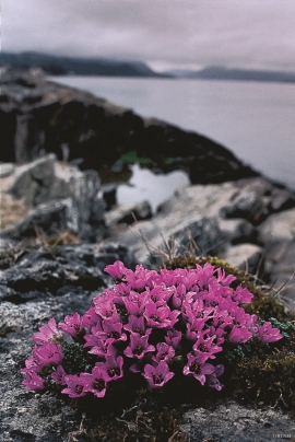

Huglo
The majority of Huglo is bare rock. A bit of dwarf pine forest is the only vegetation able to put down roots. Along the west- and east sides, to the contrary, the landscape is unusually green and lush. The reason lies both in the bedrock and in the ice that covered the area 12 000 years ago.


