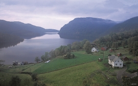
Haganes
The gneiss landscape west and north of Bergen viewed in profile can remind us of a saw blade of the kind that has long, slanted sides that get broken off shorter transverse sides. It has taken several hundred million years to file this saw blade, an enduring interplay between various geological processes.

Vatlestraumen
There are coal bits hidden in the sand under Vatlestraumen. These remains from a geological layer from the Jurassic Period were discovered when the undersea Bjorøy Tunnel was built in 1994. Oil- and gas reservoirs in the Troll Field in the sea west of Hordaland are from the same time. It is, nonetheless, quite surprising to find bedrock from dinosaur time inside of the outer islands of western Norway. On the Scandinavian mainland north of Denmark, there are only a very few places where one f inds rock from this time in earth history.
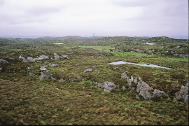
Fedje bog
The wild rabbit is really native to Northwest Africa, but the Ancient Romans introduced them to large parts of Europe. Not to Norway, rightly enough: the population on Fedje originated from 3-4 pairs that were brought here from the Shetland Isles in 1875, making this their first residence in the country.


Stall
The Bergen Arcs have an unusually sharp boundary to the bedrock in the east. Geologists think that this was caused by movements in the earth's crust during the Devonian Period. Then, the Bergen Arcs on the Lindås peninsula sank a whole 10 kilometres in relation to the Precambrian basement gneisses on the east side of Fens Fjord and Aust Fjord.
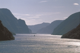
Veafjorden
Some decades ago, Veafjord and the currents in toward the bigger rivers were the most likely places to see harbour seals in Hordaland. In the summer flocks lay on the beach and waited for the salmon to trickle in. Sometimes they also followed the fish a little way up the river.

Fitjarøyane
If we study the group of islands south of Selbjørns Fjord from the air or on a sea map, we will notice that many of the islands are elongated and lie systematically in rows. The islands are divided by long sounds, for example Trollosen, Nuleia and Hjelmosen, which are oriented in a south-southeast to north-northwesterly direction.