- Remove Cultural landscapes filter Cultural landscapes
- Remove Voss, frå 2020 del av nye Voss herad. filter Voss, frå 2020 del av nye Voss herad.
- Remove Kvinnherad filter Kvinnherad
- Remove Coniferous forests filter Coniferous forests
- Remove Glaciers filter Glaciers
- Remove Lakes, rivers and river networks filter Lakes, rivers and river networks
- Remove Rock carvings filter Rock carvings

Bondhusdalen
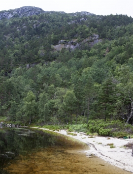
The Bondhus area in Maruanger has been a magnet for tourists ever since the stream of tourists to Norway's west coast began in the middle of the 1800s. The magnificent landscape with the "ice trail" up to Bondhusvatnet Lake, the ice falls from Bondhusbreen glacier and Keisarstigen trail up to Folgefonna are still popular tourist attractions.


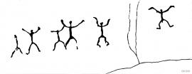
Årsand
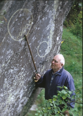
Below a south facing, steep rock at Årsand, there is one of the strangest ancient relics in the whole of Hordaland. The jutting rock wall forms a shallow flagstone – Geithilderen. Parts of the rock wall are covered by a light lime crust and on the crust figures have been painted in golden and rusty red colours.

Ulvund
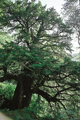
One of the oldest farms in Myrkdalen, Ulvund, is recognized as one of 14 areas in Hordaland having an especially valuable cultural landscape. The dirt road runs along a steep slope down toward Lake Myrkdalsvatnet. The flattest field, which today is harvested for silage, used to be an old grain field, while the slopes were old hayfields.


