- Remove Small landforms filter Small landforms
- Remove Middle age filter Middle age
- Remove Eidfjord filter Eidfjord
- Remove Modalen filter Modalen
- Remove Etne filter Etne
- Remove Askøy filter Askøy
- Remove Fish filter Fish
- Remove Late glacial filter Late glacial

Nedre Helland- Sand Quarries
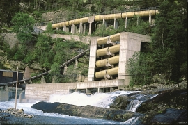
The three spades in the municipal coat of arms for Modalen are sand spades. Sand quarrying has brought income and employment. As much as 70,000-80,0000 tonnes of sand and gravel left the municipality each year since the turn of the millennium, to be used as cementing sand. Why is Modalen endowed with so much sand?


Fruo
At Fruo, nature has built its own little "Chinese wall ". Some kilometers south of the Vøringsfossen waterfall, there are a number of moraine ridges, the longest and most notable of their kind in Hordaland.

Hæreid- geology
The Eidfjord terrace is a gigantic ridge that reaches up more than one hundred metres from the city centre in Eidfjord. It serves as a powerful natural monument left behind by the ice when it retreated.

Mostraumen
Until 1743 the people from Modal had to wait for a flood in MOSTRAUMEN before they could draw their boats up the river current, and then row back across Lake Movatnet. But, that year the flood opened a free passageway all the way to Mo. Hordaland had gained a new tidal waterway.

Herdla – glacial deposits
The shift in the landscape is striking between the barren craggy moors north on Askøy and the green fields of Herdla, which has the county's biggest farm. The majority of Herdla, such as the island appears today, is a gift from the glacier: The glacier that advanced here over 12,000 years ago stopped at the northern tip of Askøy and took its time building up the moraine on Herdla. Since then, Herdla has been under continual transformation. The re-organisation of the loose sediment deposits continues today.

Mosnes
The permanently-protected Mosneselva River, with its meltwater from Folgefonna, runs out into Åkra Fjord by the roadless and uninhabited Mosnes. Those who once lived here were forced to surrender to the ravages of Nature. In the autumn of 1962 there was a flood so great that the people were driven from their farms.

Skånevik- moraine
In Skånevik there are marks left from the ice edge that advanced during the thousand-year cold spell (Younger Dryas) that marked the end of the Ice Age roughly 11 500 years ago. The glacier first proceeded out into Åkra Fjordand and around Vannes and thereafter sent an arm in toward Skånevik. Here, the glacier lay down an end moraine up against the mountainside.

The village of Etne
Much of the sand and gravel that the town of Etne is built on was laid down at the end of the Ice Age and is evidence of melting glaciers and roaring meltwater rivers. The uncompacted material in the big terraces leave their unmistakeable mark on the wide elongated valleys.

