- Remove Small landforms filter Small landforms
- Remove Middle age filter Middle age
- Remove Livelihood and Craftsmanship filter Livelihood and Craftsmanship
- Remove Road constructions filter Road constructions
- Remove Wildlife filter Wildlife
- Remove Place filter Place
- Remove Benthic organisms filter Benthic organisms
- Remove Farm sites filter Farm sites
- Remove Hydro power filter Hydro power
- Remove Industry, Energy and Natural Resources filter Industry, Energy and Natural Resources

Dale power station
In 1923 Bergenshalvøens Kommunale Kraftselskap (BKK) expropriated large areas for power plants and development of hydropower started soon afterwards. Dale power station with the two first aggregates, each of 14 MW was put into operation on 17 November 1927. In the supply reservoir in Storefossen 5152 cubic metres of concrete were cast, and a modern and well-equipped power station was built.


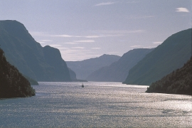
Veafjorden
Some decades ago, Veafjord and the currents in toward the bigger rivers were the most likely places to see harbour seals in Hordaland. In the summer flocks lay on the beach and waited for the salmon to trickle in. Sometimes they also followed the fish a little way up the river.

Eksingedalen- hydropower development
Water discharge at the outlet of the Ekso into Eidsfjord was halved after the big hydropower development in the mountainous area between Modalen and Eksingedalen and further southward toward Evanger in the 1960s, 70s and 80s. In an attempt to amend the changed environmental conditions in the waterway the developer built 35 small dams in the river.
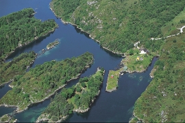
Lure Fjord
Both Lure Fjord and Lindåsosane to the inside give good living conditions for rare marine organisms: jellyfish, shellfish and fish. These include animals that migrated in after last the Ice Age, when the sea level was higher. Eventually, as the land rose, some of these populations became isolated.

Toftestallen
The large coastal waves that crash down on the islands west in the sea gather their energy from storms and winds all the way out in the North Atlantic Ocean. The most common place of origin is nonetheless the North Sea. When these waves break over the skerries and islets along the shore, or on the rocky outermost islands, their energy is released. This takes the form of turbulence in the water and sea spray up on land. Can the enormous energy contained in the waves be exploited?

Frøland
Much rain, a steep drop and nearness to Bergen meant that the power-making potential of the Samnanger water system was exploited early. Samnanger was thus one of the first power-producing municipalities in western Norway. With its subsequent expansion and new power stations, about 400 gigawatts of electricity per hour were produced on average each year. This is enough to meet the energy needs of 25,000 households.
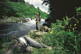
Oselva
Oselvo is the biggest waterway on the Bergen peninsula, with sources in Gullfjellet and Sveningen. There is a fall of only 60 metres along the entire stretch from Samdalsvatnet Lake to the sandbank in Fusafjorden. It is rare to see a river like this in western Norway. There is salmon along this entire section of the Oselvo river.

