- Remove Mineral resources filter Mineral resources
- Remove Place filter Place
- Remove Vegetation history filter Vegetation history
- Remove Faults filter Faults

Fitjarøyane
If we study the group of islands south of Selbjørns Fjord from the air or on a sea map, we will notice that many of the islands are elongated and lie systematically in rows. The islands are divided by long sounds, for example Trollosen, Nuleia and Hjelmosen, which are oriented in a south-southeast to north-northwesterly direction.

Fjøsanger
Fjøsanger is known among ice age researchers from around the world. Under an excavation in 1975-77, geologists from the University of Bergen found layers from the last interglacial, ca. 115 000 to 130 000 years old.


Geitaknottane
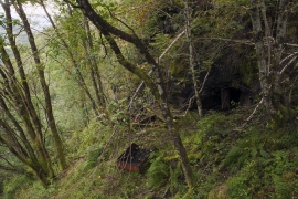
Many travellers between Mundheim and Gjermundshamn are captivated by the expansive view toward Øynefjord, Varaldsøy and Folgefonna. The barren pine forest on the slopes on the upper-side of the road is not seen by many. Who would think that this area is home to rare species of plants and animals, creatures who have made their homes here for thousands of years?


Grønafjellet
Mountain plants with their beautiful, colourful flowers are common in high altitude areas in Norway. On the coast there are not so many of them. But, here and there one nonetheless finds mountain plants, and this makes some coastal mountainsides a little bit different. Perhaps the growth on these mountainsides gives us a little glimpse of a distant past?

Haganes
The gneiss landscape west and north of Bergen viewed in profile can remind us of a saw blade of the kind that has long, slanted sides that get broken off shorter transverse sides. It has taken several hundred million years to file this saw blade, an enduring interplay between various geological processes.

Jonstein
When high school student Arne Handegard collected plants for a herbarium in 1962, he didn’t know what kind of rarity he had pressed into his notebook. 30 years later he attended a botanical lecture, where a picture was shown of a plant he recognized: “Norwegian Sagebrush, which in Norway is only found in a large area of Dovre and in Trollheimen, and in a little area in Ry county”. Arne Handegard raised his hand: “That plant grows on Mt. Jonstein in Jondal”.

Krokavatnet
On Sunday the 29th of January, 1989, at 17:38 o'clock, Etna shook. The earthquake, with its epicentre ca. 9 kilometres south of Etne centre, had a strength of 4.2 on the Richters scale. This could be felt over large parts of West Land, especially in the areas around Åkra, Etne, Hardanger Fjord and Sauda Fjord. The earthquake was the largest that has ever been measured in Hordaland.

