- Remove Quarns and mills filter Quarns and mills
- Remove Thrust sheets filter Thrust sheets
- Remove Landscape filter Landscape
- Remove Conservation area filter Conservation area
- Remove Wildlife filter Wildlife
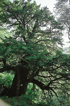
Holmedalsberget
If you want to be on your own for a long day in a magnificent deciduous forest in demanding terrain, then HOLMESDALSBERGET is the right place. This is a big forested area by Matres Fjord in the southwestly part of Kinnherad. Here, we find one of the largest deciduous forests in Hordaland. The forest stretches over several kilometres.

Hereiane
At Hereiane on warm summer days one you can walk barefoot up the hill from the fjord all the way up to 400 metres elevation. The naked, furrowed bedrock often causes travellers who see it from the north side of the fjord to wonder. Why does it look like this, and why is there so little that grows here? It is a long way to the heavy metal industry in Ålvik and Odda, and there hasn’t been a forest fire in modern times.

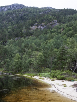
Vinnesleira
Bays that are shallow far out into the sea, with fine sand and clay, are rare in Hordaland. Where they are found, the reason is usually that the edge of the glacier made smaller advances or stopovers when it calved back at the end of the last Ice Age. This is what happened at Vinnesleira.

Bjoreidalen
Bjoreidalen is one of the classic bird localities on Hardangervidda. It is especially known for its wading birds, with as many as 17 of the 19 wader species that nest in Hordaland.

Langavassmyrane
The Ruff lek on Langvassmyrane is the only known phenomenon of its kind on Hardangervidda. Every year it attracts hens from the whole plateau. The marsh is also the richest wetland in the county. This green oasis is located in a rocky moraine landscape a few hours walking distance south of Dyranut.

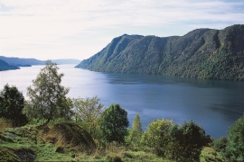
Granvinsvassdraget
After the ice age, Granvin Fjord reached all the way up under Skjervsfjossen waterfall. Just a thousand years later, as a result of the rising of the land after the ice melted, this whole inner part of the fjord freed itself of the sea and became Granvinsvatnet lake. In spite of this rise in elevation, this waterway is still navigable for fish: Sea trout have wandered into Granvinsvatnet in more recent times and evolved to become freshwater trout. And salmon and sea trout made the journey 13 kilometres up the Storelvi river.

Rallarvegen
They rest there, all as one, the silent witnesses of Western Norway's saga of creation: Precambrian basement, phyllite and thrust sheet. In the end came the glaciers and sculptured the vast landscape. Along the ground or on the horizon, from bicycle or on foot - the landscape tells its story - and it tells it clearer on Rallarvegen than many other places.

Ulvikapollen
When the lush beach area innermost in Ulvikapollen was protected, the bird life was instrumental to the decision. The plant diversity is just as impressive. In Hordaland sea meadows such as this are rare small in size - they are more common in coastal environments.

