- Remove Boat- and shipyards filter Boat- and shipyards
- Remove Wetland filter Wetland
- Remove Hardanger og Voss filter Hardanger og Voss
- Remove Fish filter Fish
- Remove Large landforms filter Large landforms
- Remove Road constructions filter Road constructions

Agastølen
Whoever wanders the mountain plateau will form time to time hit upon old mountain summer farms, with solid old stone sheds, half sunk into the ground; a building tradition that has roots into prehistoric times. When we have been satiated with untouched Nature, it is somewhat comforting to come upon the old mountain chalets - they represent a type of human encroachment that we not only accept, but appreciate. They arouse a feeling of recognition and are a distinct witness to how people in the rural communities have made use of even the most remote resources.

Berge
Down by the fjord on the farm Berge in Tørvikbygd, is Stekkavika – a sheltered eastward facing harbour, protected against the fjord by headlands and rocks, even manifest in the name. Here is also a comprehensive milieu of coastal industry, with boathouses and sea-sheds that belong to the farms Berge, Heradstveit and Halleråker. Belonging to the farm Berge there is also a mill-house, circular saw, workshop for sloop building, and – a little further up into the woods – the old water-powered sash-saw.

Dyrskard
Right from the start the road across Haukelifjell was a road from “fjord to fjord”, from the bottom of Sørfjorden to Dalen in Telemark. The connection between Røldal-Haukelifjell was considered so important by Stortinget (Parliament) that the road construction Odda-Dalen was approved already in 1853.


Granvinsvassdraget
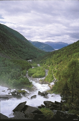
After the ice age, Granvin Fjord reached all the way up under Skjervsfjossen waterfall. Just a thousand years later, as a result of the rising of the land after the ice melted, this whole inner part of the fjord freed itself of the sea and became Granvinsvatnet lake. In spite of this rise in elevation, this waterway is still navigable for fish: Sea trout have wandered into Granvinsvatnet in more recent times and evolved to become freshwater trout. And salmon and sea trout made the journey 13 kilometres up the Storelvi river.


Hårteigen
Hårteigen, «the grey signpost», as the name suggests, is a landmark for mountain hikers on the western plateau. The piece of mountain is also a monument for the mighty rock layers that once covered the entire plateau.

Krækkjavassdraget
Few other animal species on Hardangervidda have been as much the focus of scientific research as the spotted trout. The spotted trout is considered to be a genetic variant of brown trout. It lives in parts of the Krækkjav water system. Otherwise, on a world scale, this species is only found in a small area in Kaukasus, and possibly also in a lake in Rondane.

Langavassmyrane
The Ruff lek on Langvassmyrane is the only known phenomenon of its kind on Hardangervidda. Every year it attracts hens from the whole plateau. The marsh is also the richest wetland in the county. This green oasis is located in a rocky moraine landscape a few hours walking distance south of Dyranut.

